
Posted by Jody Peters
The crew at Notre Dame is in the process of entering PLS data for Indiana. Recently we focused on the area around Notre Dame and South Bend. Here is the area as depicted in the 1829 PLS survey, 13 years before Notre Dame’s founding.
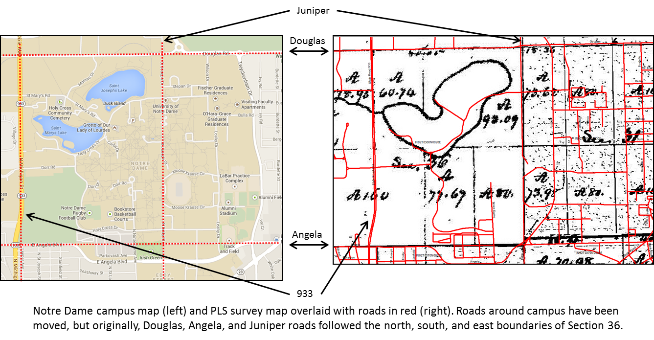
 It has been interesting to learn about the changes that have taken place around campus. While the major roads around Notre Dame (Angela, Douglas and Juniper) were originally based off the PLS survey, all three roads have had sections of them moved.
In the 1829 survey, the two lakes on campus were drawn as one. We aren’t sure if this is because the surveyor was in a hurry and didn’t take time to explore the lakes further or if he was surveying in the winter when the lakes were ice covered. But from historical documents at Notre Dame there are a number of references to two lakes, although the lakes water levels have been known to fluctuate and at some points were quite high making the area between the lakes quite swampy.
At the time of the PLS survey the Notre Dame area was dominated by oaks. But another tree found in the area that was of interest to the lab was the pepperage tree. The pepperage tree, or more commonly spelled, pepperidge is also known as sour gum, black gum or black tupelo. As a side note, the pepperidge tree is where Pepperidge Farms get their name (got to love those goldfish crackers)! To learn more about pepperidge trees, check out this great site. Keep up to date with ND’s data entry progress by clicking on Indiana map at our Settlement Vegetation Site.