10th World Dendro Conference Re-cap

Post by Ann Raiho, Kelly Heilman, and Andria Dawson. This post is cross-listed on the McLachlan lab website.

The 10th World Dendro Conference was held in Bhutan this summer! A Dendro Fieldweek was held the week prior to the conference where individuals learned about dendrochronology and reconstructing climate from tree rings, forest ecology and forest dynamics.  PalEON had 4 participants including two grad students from the McLachlan lab.  Below are the impressions and experiences from McLachlan members, Ann Raiho and Kelly Heilman and PalEONista, Andria Dawson.

Ann’s Impressions
Bhutan was an excellent destination for World Dendro for many reasons, mainly the country’s unique perspective on forest conservation. Bhutan is the only country in the world that could be considered carbon neutral or even carbon negative because of the amount of forest that the country preserves. Over 70% of Bhutan is forested and will remain so for the foreseeable future. The fourth king set in place a mandate that the country should always remain 70% forests. So many trees! Furthermore, Ed Cook and Paul Krusic have been working in Bhutan for over 25 years and have helped the Bhutanese establish a proliferate tree-ring lab that has been in operation since 2001.

Bhutan is known as the Land of the Thunder Dragon. The Bhutan flag (right) shows an image of Druk, the Thunder Dragon

I attended the Dendro Fieldweek. Around 30 international students and 20 Bhutanese students traveled 14 hours by bus to Bhumthang, Bhutan where there is a field station located next to the first queen’s palace.

Views from the Bus

The field week consisted of field work, tree ring analysis, and presentations of findings. There were groups working on dendroecology, dendrohydrology, and blue light intensity measurements. The dendroecology group was led by PalEONista, Neil Pederson!

Mounting and Measuring Tree Cores

Tree Cookies

We explored the relationship between fir and hemlock along an elevational gradient and found that fir growth may be more sensitive to increasing temperature. At the end of the week everyone presented in their groups, my group’s presentation was about dendroecology and how you can incorporate disturbance history and biomass estimates to tell a story about the forest’s development.  I snuck some LINKAGES (forest gap model) runs in to show how ecosystem models can be used in conjunction with tree ring data to learn about limiting resources over successional time scales. Our final night at the field station was spent dancing around a bonfire in traditional Bhutanese fashion (pinky’s locked together to form a circle) and singing karaoke.

Exploring the Forests of Bhutan

Kelly’s Impressions
A traditional Marchang ceremony opened the conference and kicked off a fun dendro-filled week.The first section of talks discussed fusing both forest inventory analyses and dendrochronology methods and included awesome talks from two of our own PalEON members (Ann and Andria Dawson). Throughout the week, I learned about researchers around the world using dendrochronology to reconstruct volcanic events, to explore past human-environment interactions, and to better understand the impacts of earthquakes of forest disturbances. My favorite section was the encouragingly large dendroecology section (I’m biased), which discussed quantifying forest disturbances, the impacts of management and land-use on tree growth, and ultimately exploring how ecological variation might affect growth-climate relationships. I gave a talk in this section titled “Anthropogenic changes impact drought sensitivity across a savanna-forest biome boundary,” which highlighted results showing that both stand structure changes and increases in CO2boundary can impact drought sensitivity at the savanna-forest boundary.

To wrap up the conference, Soumaya Belmecheri gave a stellar Florence Hawley Diversity Lecture that blended both her research reconciling the differences observed between tree ring data and Eddy Flux data and an eloquent call for supporting greater diversity in dendrochronology. In between our packed conference schedule and before leaving Bhutan, we squeezed in some culture and exploration. My favorites were the traditional dancing at the conference banquet, venturing up to the massive Buddha, trekking up to Taktsang Buddhist monastery (aka “Tiger’s Nest”) with Andria, and eating all the spicy ema datshi and momos possible!

Some short hikes brought us to amazing views! Left: views from the large Buddha temple in Thimphu. Middle: Buddha Dordenma statue. Right: A large prayer wheel on the way up to Taktsang monastery near Paro. Look closely at the prayer wheel and you’ll see one of the friendly dogs that accompanied us on our hikes and always found the best napping places!

Hiking to Taktsang Monastery (Tiger’s Nest) with Andria. Taktsang monastery is located on a cliffside around 10,000 ft elevation. We enjoyed the pine forests, prayer flags, and views of the valley on the way up!

Andria’s Impressions
Bhutan has undergone a wave of modernization over the last 40 years. They are now at a point in time where they have the infrastructure to conduct and disseminate scientific research. Ed and Paul have been working in collaboration with Bhutanese colleagues for some time; however, there is still a lot to learn about the forests of Bhutan (and how they fit into our global perspective of the biosphere). Our Bhutanese colleagues at the conferences continued to emphasize their commitment to collaboration with international colleagues.

I want to thank the people of the Kingdom of Bhutan for welcoming us. Their generosity and profound appreciation for the environment and all living things has had a profound impact on my perspective of life and humanity. Bhutan, you are far away (from North America) but never forgotten.

Left: PalEON Pals, Middle: Traditional Dancers at the Closing Banquet. We all joined later!, Right: A Good Reminder To Go Home With

Oak Trees and Climate in the Midwest

Post by Kelly Heilman, a graduate student with Jason McLachlan at the University of Notre Dame

If trees could talk…

Every year, oak trees in the Midwest awaken in spring, to spread their leaves to grow through the summer, and settle down for a long winter’s rest in the fall. As we watch this seasonal cycle, trees warn us of the coming of winter as they shed their leaves, putting on a glorious show of red, gold and orange. At times, trees tell us to slow down by inviting us into their expansive shade to rest, read a book, and listen the birds sing in the distance. However, to many dendrochronologists, trees talk about something else–their records of the past. The patterns of each season’s tree growth are recorded in the annual rings of trees, and are protected like a memory beneath the tree’s bark. These annual variations in tree rings provide researchers with information on the responses of trees to climate variations, as well as to other stresses that trees face, such as competition with their neighbors for light, and fire disturbances. All this makes tree ring records particularly useful tools for looking into the past. So, in a way trees can talk . . . but it takes some effort for us to listen to them.

Trees in the temperate zone, such as this Bur Oak, record annual rings of growth, allowing us to count their rings to get tree age, and correlate growth with climate records. Pictured above is a 5-mm wide core sample from a tree at Bonanza prairie SNA (Scientific and Natural Area) in Minnesota, with the bark pictured on the left and the center of the tree on the right. (Click on image for a larger view.)

Looking at the past responses of ecosystems to climate variations through the lens of tree rings can provide a better understanding of how these ecosystems might respond to future changes. My research focuses broadly on the savanna-forest boundary in the Midwest, both on the environmental conditions that form this boundary and how environmental changes impact these savannas and forests. Over the last century, humans have altered the landscape in the Midwest, through large scale agriculture, land-use change, fire suppression, changes in CO2 and climate shifts (Goring et al. 2016, Rhemtulla et al. 2007). Many of these changes have likely affected the growth, survival, and climate sensitivity of trees, which could impact the trajectory of forests in the future. Therefore, I set out to quantify how savanna and forest trees functioned both in the past, and on the modern landscape. Using annual growth increments recorded in tree rings, my objective was to quantify how both modern and past ecosystems functioned (in terms of how much carbon they uptake and store in their annual growth rings), and to determine if and how tree growth patterns vary across temperature, precipitation, and soil gradients.

Thoughts from the field (don’t forget your bug spray and sunscreen):

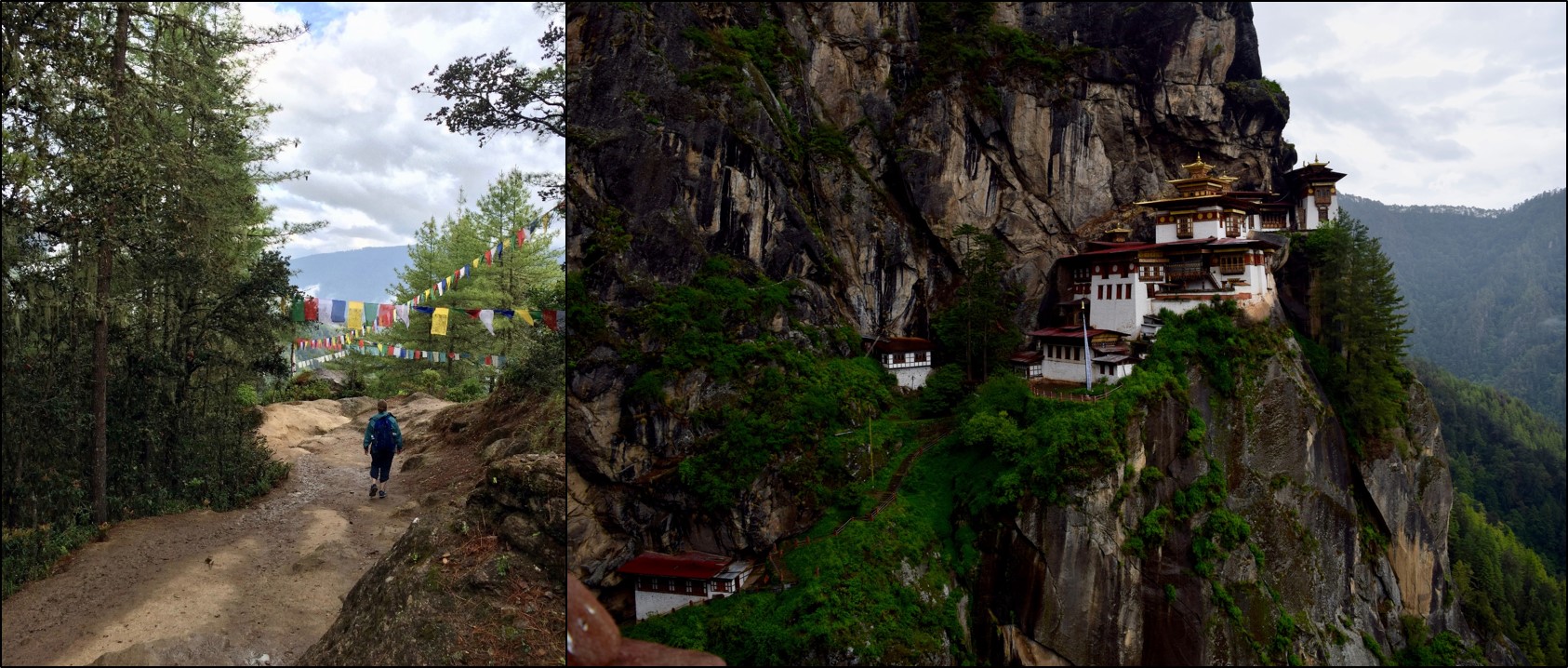
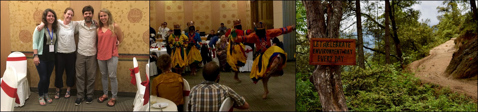
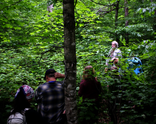
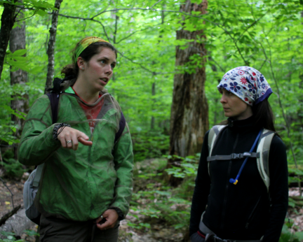
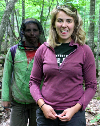
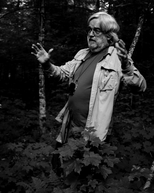
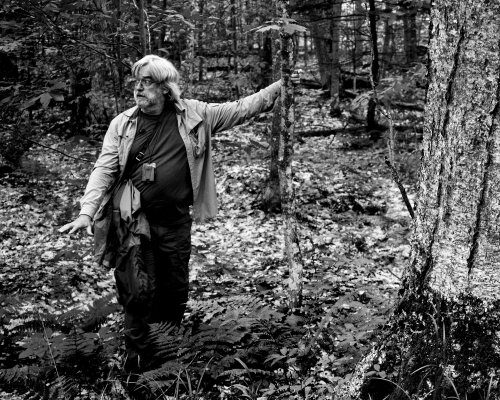
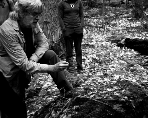
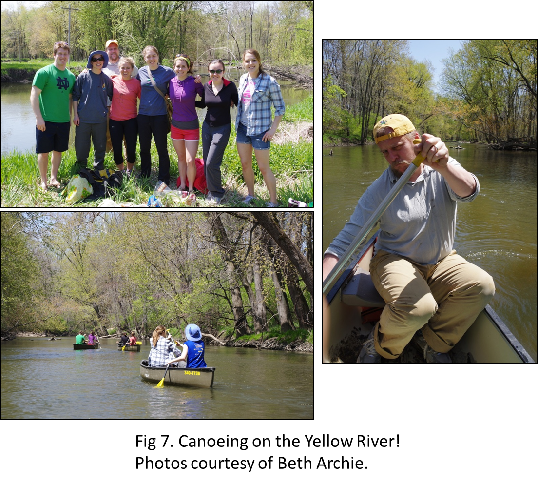
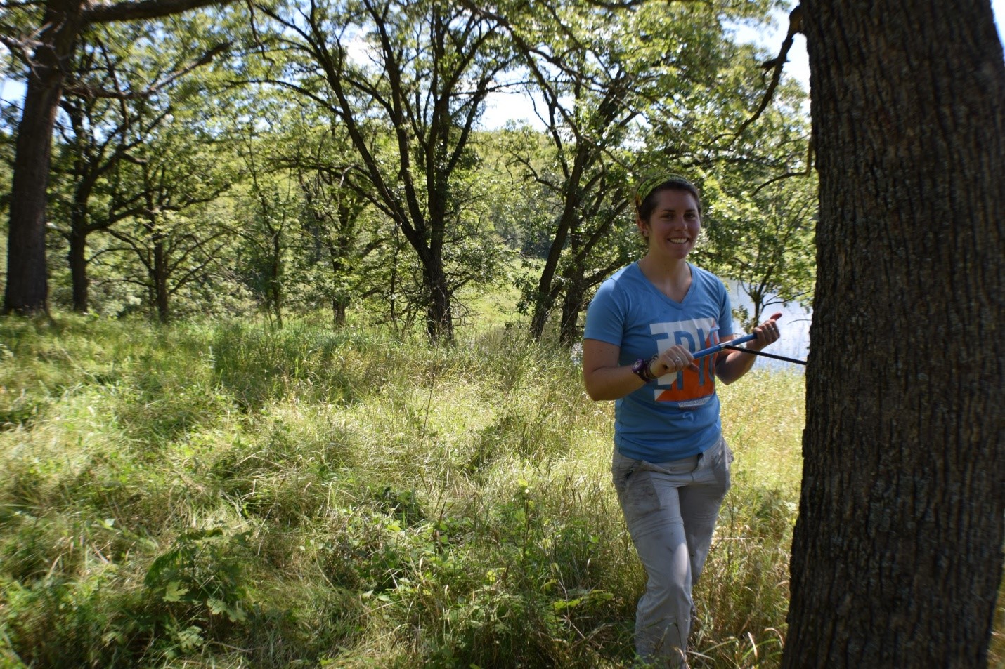
To view the annual rings of tree growth, we collected tree core samples from sites across the historic savanna-forest boundary in the Midwest from several Minnesota Scientific and Natural Areas (SNAs), Minnesota State Parks, State Parks in Iowa and Missouri, as well as several sites within McHenry County Conservation District in Illinois (see map). In my sampling design, I aimed to capture the growth responses of young and old trees in both savannas and forests, across the wet-to-dry climate gradient in the Midwest. We targeted several Oak species, including Bur Oak (Quercus macrocarpa), White Oak (Quercus alba), Red Oak (Quercus rubra), and Chinkapin Oak (Quercus muehlenbergii), but also sampled several eastern forest species as well. With the help of fellow Paleonistas (Ann Raiho, Monika Shea) and field technicians Evan Welsh and Santi Thompson, we sampled tree cores at 23 different sites during the summers of 2015 and 2016. Coring trees can be monotonous, physically difficult, and relaxing all at the same time. Lucky for us, we got to go to some beautiful places across the Midwest.

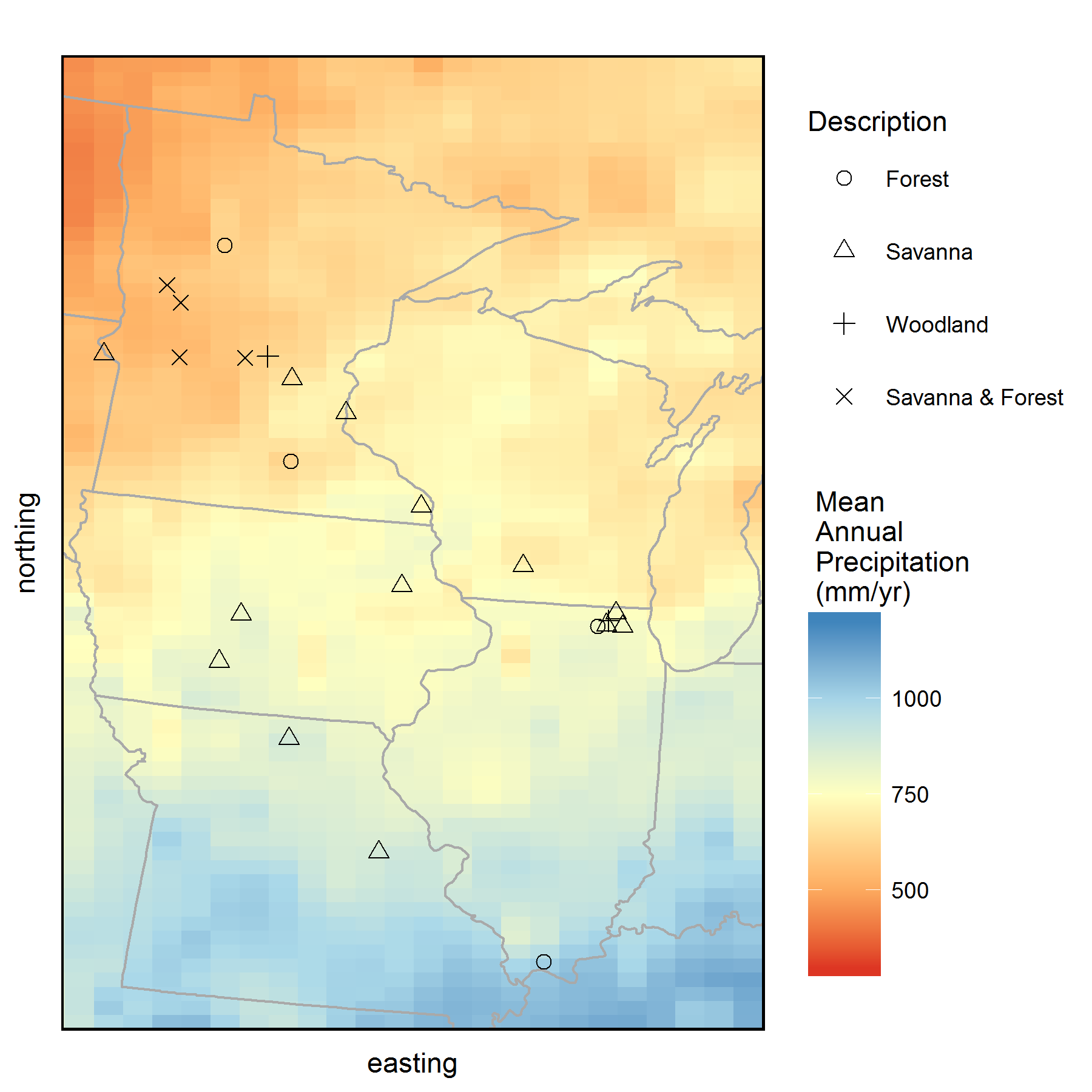
Map of all the sites where we collected tree core samples from during 2015 and 2016. Background color represents mean annual precipitation (MAP) of the region obtained from PRISM climate data. Tree cores were collected from savannas and forests that occur along the historic prairie-forest boundary in the Midwest. (Click on image for a larger view.)

Coring a large Bur Oak tree in a savanna at Maplewood State Park, Minnesota.

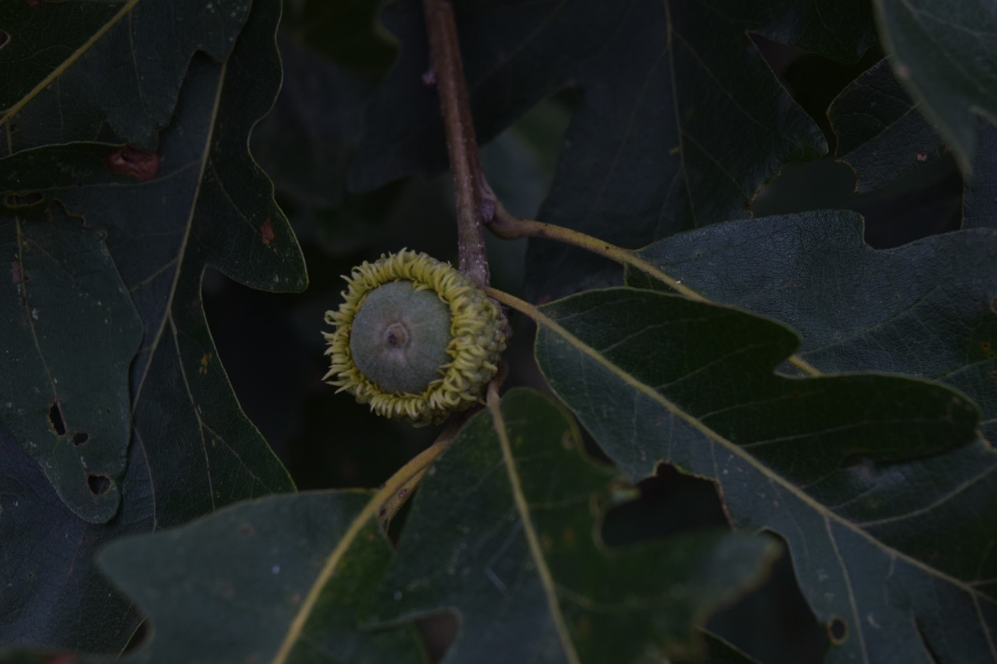
Bur Oak acorn from a young tree located in St. Croix savanna SNA in Minnesota

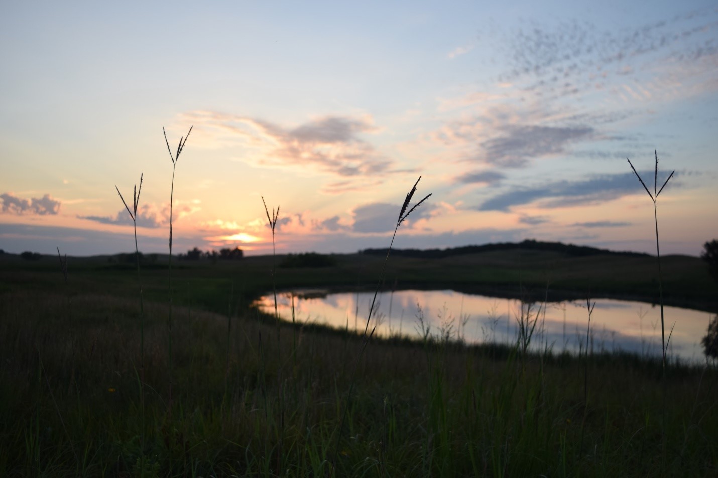
Working out in the field gave us opportunities to see some awesome ecosystems and sunsets. Looking out onto to prairie from a savanna at Glacial Lakes State Park, MN, the tallest plants were not trees, but tallgrass prairie plants, such as the Big Bluestem, or “turkey foot” (Andropodon gerardii) pictured here.

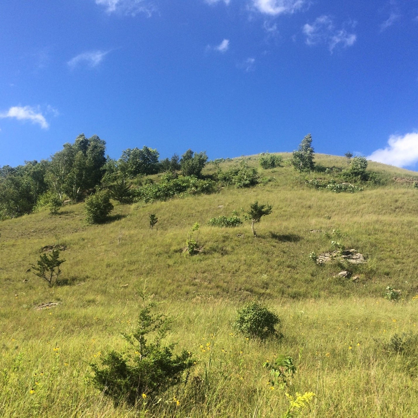
An open savanna and prairie complex at Mound Prairie SNA, in Minnesota.

The Oak savanna canopy is sparse compared to a closed forest, letting in plenty of light for understory grasses and forbs to grow.

After driving a couple thousand miles total, spending over 30 nights in a tent in 2015 and 2016, and battling what seemed like an infinite amount of mosquitoes and ticks, we headed back to the lab to measure the width of each annual tree ring, and determine how climate affects Midwestern oak tree growth.

Back at the Lab:

Once we returned from the field, the cores were glued to wooden mounts, sanded, counted and measured. This work was done with the help of several awesome undergraduate students over the last two years, including: Jacklyn Cooney, Clare Buntrock, Santi Thompson, and Da Som Kim. Once the cores were measured and cross-dated with each other (using common “marker” years of extremely low growth, such as the 1934 Dust bowl drought, to double check our measurements), we have a temporal record of growth fluctuations for each site.

What climate factor affects oak tree growth in savannas and forests?

Tree growth responds strongly to the most limiting factor to their growth.

For example, in water limited regions of Southwestern North America, tree growth is highly correlated with interannual precipitation and drought, often making tree ring records from these regions good candidates for precipitation reconstructions (Charney et al. 2016, Peterson 2014). However, in many Eastern North American forests, water availability for growth is not a huge limiting factor, and tree growth is more sensitive to summer temperatures, drought, and light availability (Peterson 2014, Charney et al. 2016).  The savanna-forest boundary in the Midwest is located between these Eastern closed forests and the more water limited prairies to the West. Therefore, tree species that occur along this boundary are often thought to exist at the edge of their theoretical and climatic range boundaries, and theoretically could respond strongly to moisture stress or temperature stress. The historic transition from open prairie to savanna to forests occurred at a range of precipitation and temperature climatic envelopes; this transition zone in Minnesota had low mean annual precipitation (300-600 mm/year), and much higher mean annual precipitation in Indiana & Illinois (700-1200). Therefore, I originally hypothesized that these western savannas and forests may respond more strongly to low precipitation and drought than Eastern savannas and forests.

Contrary to my original hypotheses, oak tree ring growth is not primarily controlled by precipitation in oak trees near the savanna-forest boundary. Rather, tree growth at most sites is strongly linked to summer drought severity and summer temperatures. The negative impacts of drought on tree ring growth are likely mediated by temperature-induced drought stress, as suggested by the strong negative correlations with minimum and maximum June and July temperatures at almost all sites. While growth at some sites is mildly correlated to late summer precipitation, these places tend to have sandy soils, suggesting that future decreases in precipitation could have larger negative consequences for tree growth on sites with sandy soils. Interestingly, despite low moisture availability, sites with the lowest mean annual rainfall were only weakly correlated with monthly precipitation, suggesting that perhaps these systems are relying heavily on deeper groundwater sources for water. However, sites with low rainfall, such as Bonanza Prairie SNA in Minnesota, do have strong sensitivity to drought indices (Palmer Drought Severity Index, PDSI) and temperature indicating that high temperature drought stress, rather than water stress due to low precipitation is more important in this ecosystem.

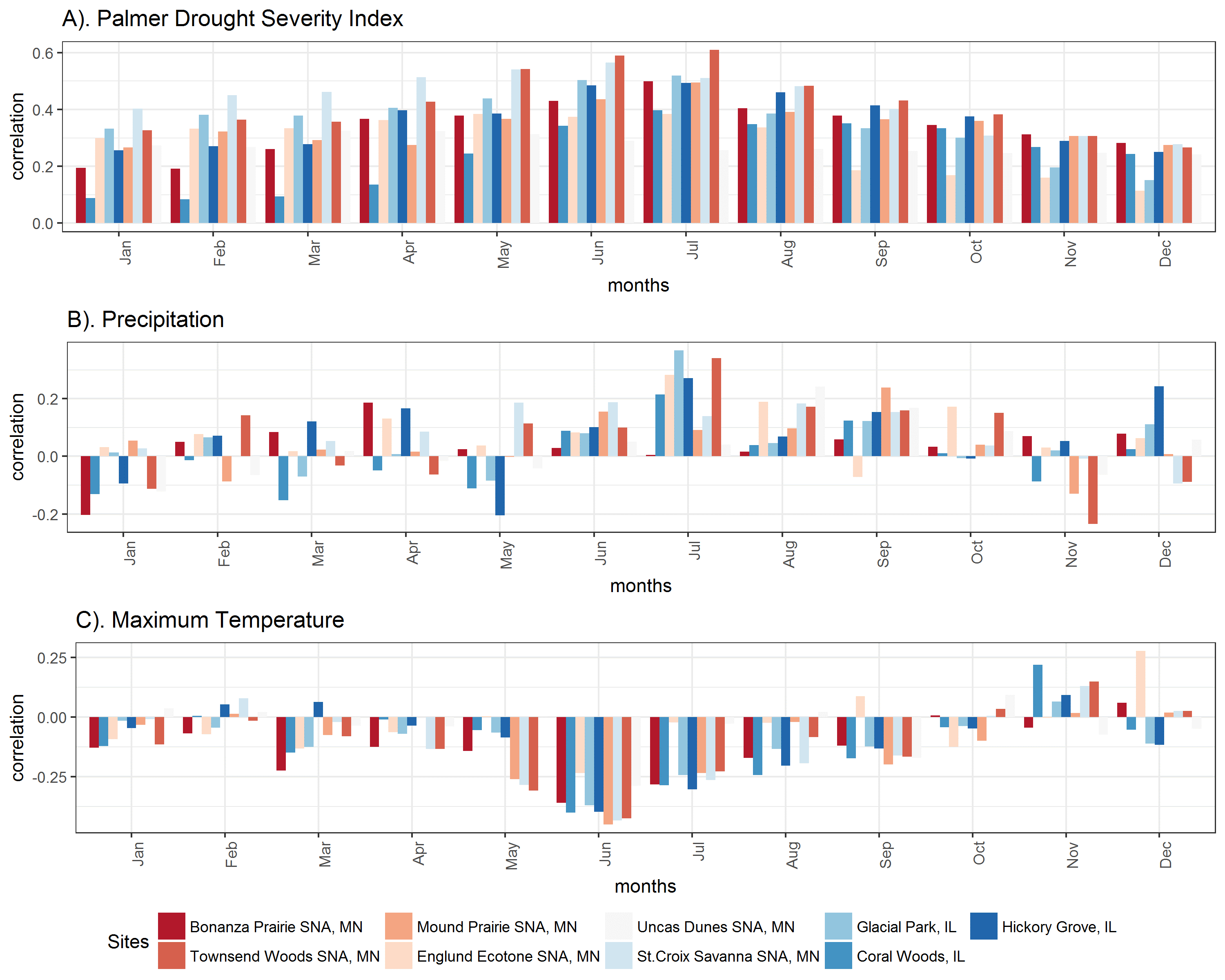
Correlations with monthly climate indicate that Oak trees at most sites are most sensitive to summer drought index and summer temperatures, but few are strongly sensitive to monthly precipitation. Red colored sites have lower mean annual precipitation, and blue sites have higher mean annual precipitation. A). Tree growth at all sites is most strongly correlated to summer drought (Palmer Drought Severity Index is positive in non-drought periods and negative in drought periods). B). July precipitation is only weakly correlated with growth at some sites. C). Tree growth is somewhat negatively correlated with summer maximum temperatures. (Click on image for a larger view.)

Have growth sensitivities changed over time?

The climate-growth relationship is often assumed to be constant for the purposes of climate reconstructions. However, recent dendroecological studies recognize that growth-climate relationships may change due to shifts in climate seasonality, changes in tree size class, tree competition, and possibly due to increases in atmospheric CO2 (Voelker et al. 2006). In theory, higher levels of CO2 in the atmosphere can enhance tree growth by increasing CO2 available for photosynthesis in the leaf, without changing stomatal conductance (gs, the amount of water that moves through the stomata). This results in an increase in plant Water Use Efficiency (WUE), or the amount of carbon taken up per unit of water used, which could help reduce the impacts of drought on trees (McCarroll and Loader 2004). While the effect of atmospheric CO2 on tree growth is still largely debated, past researchers found that Bur Oak (Quercus macrocarpa) trees in Western Minnesota have become less sensitive to drought since the beginning of the 20th century, and mortality due to drought has decreased  as well (Wyckoff and Bowers 2009). Additionally, Voelker et al. (2006) found that the positive effects on growth that may result from increased atmospheric CO2 likely decline with tree age. My sampling effort has extended the spatial range of oak sampling in the Midwest, allowing us to test whether a change in the growth–drought relationship over the 20th century is regional and if it has occurred in different oak species and site conditions.

With our data across the Midwest, we find preliminary evidence supporting a change in growth sensitivity to climate. Trees across the Midwest were less sensitive to drought after 1950, and younger trees established under high CO2 were also less sensitive to drought than older trees.

These results are consistent with the previous work in Minnesota (Wyckoff and Bowers 2009), and with a positive enhancement of CO2. In two of the three closed forest sites sampled, we find no difference in the growth-drought sensitivity over time, suggesting that savanna trees, but not forest trees have become less susceptible to drought in the region. While the stand structure (open savanna or closed forest) may help explain where we see shifts in growth-climate sensitivity, species sampled may also play a role, as well as the mean annual precipitation and temperature. To specifically test whether CO2 enhancement is driving the decreased drought sensitivity, I am currently working on a project that tests to see if the composition of carbon isotopes recorded within annual tree rings have changed. The ratio of heavy to light carbon isotopes can be used to quantify plant Water Use Efficiency, which will increase over time if CO2 has a net positive effect on tree growth.

Up Next…

This project is still ongoing and there are several questions that I am still exploring. I am continuing to work on a formal analysis of the tree ring growth data, and look more at species-specific sensitivities to climate, since the preliminary analyses focus on site specific responses.

If growth and sensitivity of growth to climate changes over time, I want to know if it is due to the effects of CO2, or some other factor affecting forest growth. This next year, I will be spending a lot of time in the lab quantifying stable carbon isotopes, to determine if plant WUE increases result in the decrease in drought sensitivity over time.


References:
Charney, N. D., et al. (2016). Observed forest sensitivity to climate implies large changes in 21st century North American forest growth. Ecology Letters, 19(9), 1119–1128. https://doi.org/10.1111/ele.12650

Goring, S. J., et al. (2016). Novel and Lost Forests in the Upper Midwestern United States, from New Estimates of Settlement-Era Composition, Stem Density, and Biomass. PLOS ONE, 11(12), e0151935. https://doi.org/10.1371/journal.pone.0151935

McCarroll, D., & Loader, N. J. (2004). Stable isotopes in tree rings. Quaternary Science Reviews, 23(7–8), 771–801. https://doi.org/10.1016/j.quascirev.2003.06.017

Peterson, D. L. (2014). Climate Change and United Steates Forests. In Climate Change and United States Forests. Springer. Retrieved from http://www.springer.com/us/book/9789400775145

Rhemtulla, J. M., et al. (2007). Regional land-cover conversion in the U.S. upper Midwest: magnitude of change and limited recovery (1850–1935–1993). Landscape Ecology, 22(1), 57–75. https://doi.org/10.1007/s10980-007-9117-3

Voelker, S. L., et al. (2006). Historical CO2 Growth Enhancement Declines with Age in Quercus and Pinus. Ecological Monographs, 76(4), 549–564.

Wyckoff, P. H., & Bowers, R. (2010). Response of the prairie–forest border to climate change: impacts of increasing drought may be mitigated by increasing CO2. Journal of Ecology, 98(1), 197–208. https://doi.org/10.1111/j.1365-2745.2009.01602.x

State Data Assimilation and PalEON

Post by Michael Dietze and Ann Raiho

What is state data assimilation (SDA)?

SDA is the process of using observed data to update the internal STATE estimates of a model, as opposed to using data for validation or parameter calibration. The exact statistical methods vary, but generally this involves running models forward, stopping at times where data were observed, nudging the model back on track, and then restarting the model run (Figure 1). The approached being employed by the modeling teams in PalEON are all variations of ENSEMBLE based assimilation, meaning that in order to capture the uncertainty and variability in model predictions, during the analysis step (i.e. nudge) we update both the mean and the spread of the ensemble based on the uncertainties in both the model and the data. Importantly, we don’t just update the states that we observed, but we also update the other states in the model based on their covariances with the states that we do observe. For example, if we update composition based on pollen or NPP based on tree rings, we also update the carbon pools and land surface fluxes that co-vary with these.

Figure 1. Schematic of how state data assimilation works. From an initial state (shown as pink in the Forecast Step) you make a prediction (blue curve in the Analysis step). Then compare your data or new observation (green in the Analysis step) to the model prediction (blue) and calculate an updated state (pink in the Analysis step).

There are many components in the PalEON SDA and many people are involved. In all methods being employed by PalEON modeling teams, the uncertainty in the meteorological drivers is a major component of the model ensemble spread. Christy Rollinson has developed a workflow that generates an ensemble of ensembles of meteorological drivers – first she starts with an ensemble of different GCM’s that have completed the ‘last millennia’ run (850-1850 AD) and then downscales each GCM in space and time, generating an ensemble of different meteorological realizations for each GCM that propagates the downscaling uncertainty. John Tipton and Mevin Hooten then update this ensemble of ensembles, providing weights to each based on their fidelity with different paleoclimate proxies over different timescales. In addition to the meteorological realizations, some of the techniques being employed also accommodate model parameter error and model process error (which is like a ‘residual’ error after accounting for observation error in the data).

Why are we doing SDA in PalEON?

In the PalEON proposals we laid out four high-level PalEON objectives: Validation, Inference, Initialization, and Improvement. Our previous MIP (Model Intercomparison Project) activities at the site and regional scale were focuses specifically on the first of these, Validation. By contrast, SDA directly informs the next two (Inference, Initialization). Both the SDA and the MIP indirectly support the fourth (Improvement).

In terms of Inference, the central idea here is to formally fuse models and data to improve our ability to infer the structure, composition, and function of ecosystems on millennial timescales. Specifically, by leveraging the covariances between observed and unobserved states we’re hoping that models will help us better estimate what pre- and early-settlement were like, in particular for variables not directly related to our traditional paleo proxies (e.g. carbon pools, GPP, NEE, water fluxes, albedo). The last millennium is a particularly important period to infer as it’s the baseline against which we judge anthropogenic impacts, but we lack measurements for many key variables for that baseline period. We want to know how much we can reduce the uncertainty about that baseline.

In terms of Initialization, a key assumption in many modeling exercises (including all CMIP / IPCC projections) is that we can spin ecosystems up to a presettlement ‘steady state’ condition. Indeed, it is this assumption that’s responsible for there being far less model spread at 1850 than for the modern period, despite having far greater observations for the modern. However, no paleoecologist believes the world was at equilibrium prior to 1850. Our key question is “how much does that assumption matter?” Here we’re using data assimilation to force models to follow the non-equilibrium trajectories they actually followed and assessing how much impact that has on contemporary predictions.

Finally, SDA gives us a new perspective on model validation and improvement. In our initial validation activity, as well as all other MIPs and most other validation activities, if a model gets off to a wrong start, it will generally continue to perform poorly thereafter even if it correctly captures processes responsible for further change over time. Here, by continually putting the model back ‘on track’ we can better assess the ability of models to capture the system dynamics over specific, fixed time steps and when in time & space it makes reasonable vs unreasonable predictions.

SDA Example

Figure 2 shows a PalEON SDA example for a 30 year time period using tree ring estimates of aboveground biomass for four tree species from data collected at UNDERC and a forest gap model called LINKAGES.  The two plots show the tree ring data for hemlock and yellow birch in green, the model prediction in purple and the pink is how the data “nudge” the model. The correlation plot on the right represents the process error correlation matrix.  That is, it shows what correlations are either missing in LINKAGES or are over represented. For example, the negative correlations between hemlock vs. yellow birch and cedar suggest there’s a negative interaction between these species that is stronger than LINKAGES predicted, while at the same time yellow birch and cedar positively covary more than LINKAGES predicted. One interpretation of this is that hemlock is a better competitor in this stand, and yellow birch and cedar worse, than LINKAGES would have predicted. Similarly, the weak correlations of all other species with maple doesn’t imply that maples are not competing, but that the assumptions built into LINKAGES are already able to capture the interaction of this species with its neighbors.

Figure 2. SDA example of aboveground biomass in the LINKAGES gap model. The left and middle plots are the biomass values through time given the data (green), the model predictions (purple), and the updated model-data output (pink). The plot on the right is a correlation plot representing the process error correlation matrix.


Expert Elicitation to Interpret Pollen Data

Post by Andria Dawson, Post-Doc at the University of Arizona and the University of California-Berkeley

Fossil pollen counts from sediments collected from bogs, lakes, or forest hollows tell us something about the composition of surrounding forests (read more about fossil pollen here and here). In a sediment core, pollen samples from multiple depths tell us about changes in these surrounding forests over time. Barring some rare and complex geophysical events, going deeper means going back in time. With some simplifying assumptions about how pollen travels from tree to sediment we can use counts of sediment pollen grains to quantitatively reconstruct forests of the past.

However, correlating depth with time, or aging the sediment, is a difficult problem. Sediment accumulates at rates that vary through time, resulting in non-linear age-depth relationships. This means that knowing the sampling year – or the age of the surface sediment – is not enough to reliably estimate the ages of samples from further down in the sediment. This lack of information is solved with radiometric dating. Small pieces of plant material from the surrounding environment find their way into the sediment; these are macrofossils. Isotope signatures from these macrofossils can be used to determine their approximate age, and provide us with additional age-depth data points. Age-depth models can be constructed from these age-depth data points.

Another way to link depth with age is to look for signatory changes in pollen representation over time. Hallmark changes in the representation of indicator taxa allow scientists to associate sediment depths with events whose dates (ages) are roughly known. In the upper midwestern US, European settlement led to significant land-use changes which resulted in increases in several agricultural indicator taxa, including ambrosia (i.e., ragweed) and rumex (i.e., docks and sorrels) (Figure 1). This change in pollen representation makes it possible to identify pre- and post-settlement depths in a pollen sediment core. This matters because some scientists (including some of us on PalEON) hypothesize that major land-use changes probably caused big changes in the pollen-vegetation relationship. Were these anthropogenically-induced changes in the pollen-vegetation relationship greater than what we would expect without this external forcing? We don’t know, and might never know.

Images of A) ragweed and B) sheep sorrel.

Images of A) ragweed and B) sheep sorrel.

Nevertheless, we want to identify what we often refer to as the settlement horizon in the pollen records for at least two reasons. First, it allows us to compare pollen from the time of European settlement with public land survey records. Second, it is often used as an additional age-depth data point in the construction of age-depth models. But how easy is it to identify this settlement horizon? Recent work shows it is not as easy as one might have thought.

The unofficial PalEON mantra is that it is better to be correct and uncertain than certain and wrong. This line of thought led us to conduct an experiment using expert elicitation, where experts were tasked with identifying the settlement horizon in pollen records from the upper midwest. Four experts each considered 185 pollen records from the upper midwest USA. For 59 pollen records the experts agreed on the location of the settlement horizon (Figure 2). For the remaining records, there was some level of disagreement (Figure 3). This is not surprising, but does highlight the importance of thinking about uncertainty. Does this mean that we should disregard all previous attempts to identify the settlement horizon? The answer to this is a resounding no. The moral from all of this is that understanding your data is critical; understand its uncertainty and how this impacts your work. In the age of big-data and data-sharing, it becomes more difficult to really know your data, but the payoff is sound science. Know your data, and know it well.

To learn more about how we use results from the expert elicitation exercise referred to above, check out our recent Dawson et al. 2016 paper in Quaternary Science Reviews where we calibrate the pollen-vegetation relationship. Elicitation results have also been used to redefine controls for a new suite of age-depth models (Goring et al., in prep), which will in turn be used to assign dates to pollen samples used in vegetation reconstructions (Dawson et al, in prep).


Figure 2. Example of a pollen diagram from a site where experts were in complete agreement on the location of the representative pre-settlement sample. Samples identified by experts as pre-settlement are indicated by the dashed lines.

Figure 2. Example of a pollen diagram from a site where experts were in complete agreement on the location of the representative pre-settlement sample. Samples identified by experts as pre-settlement are indicated by the dashed lines.

Pollen Diagram Figure 3

Figure 3. Example of a pollen diagram from a site where experts were in complete disagreement on the location of the representative pre-settlement sample. Samples identified by experts as pre-settlement are indicated by the dashed lines.

References

  1. Dawson, Paciorek, McLachlan, Goring, Williams, Jackson. 2016. Quantifying pollen-vegetation relationships to reconstruct ancient forests using 19th-century forest composition and pollen data. Quaternary Science Reviews.137: 156-175. 
  2. Goring, Dawson, Grimm, et al. Semi-automated age model development for large scale databases. 2016. In prep for submission to Open Quaternary.
  3. Dawson, Paciorek, McLachlan, Goring, Williams, Jackson. 2016. Pre-industrial baseline variation of upper midwestern US vegetation. In prep for submission to Quaternary Science Reviews.

Empirically Reconstructing Biophysics with Remote Sensing Data

Post by Bethany Blakely graduate student with Adrian Rocha and Jason McLachlan at the University of Notre Dame

Biophysics is important . . . but only recently!

The exchange of energy between the land surface and the atmosphere (biophysics) plays a huge role in local and global climate. The polar ice-albedo feedback, where snowmelt reduces albedo and further accelerates melting, is an example that most readers will be familiar with. Vegetation is an important mediator of biophysical change (Figure 1). Changes in stature, phenology, water use, and other vegetation characteristics alter the exchange of energy between a vegetated surface and the surrounding atmosphere. Despite the potential climatic importance of these effects, they were often neglected in early efforts to understand vegetation-climate interactions. One contributor to the relative neglect of biophysics in past climate science may be its temporospatial misalignment with vegetation processes. Surface-atmosphere energy exchanges happen rapidly and at a local scale, making them hard to rectify with annual to centennial changes in landscape and climate.

Figure 1

Figure 1. Major ways in which vegetation affects surface-atmosphere exchange of energy. CRO = crops, DBF = deciduous broadleaf forests, ENF = evergreen needleleaf forests, GRA = grassland. Forested land tends to absorb more energy than non-forested land due to lower albedo but dissipates a larger portion of that energy through evaporation, limiting temperature increase. Zhao et al 2014


Remote sensing to the rescue?

Remote sensing is a useful tool for bridging the gap between biophysical and landscape processes. It offers a great deal flexibility in scale and is well suited to represent the kinds of things that matter for biophysics. After all, remote sensing satellites literally measure outputs of energy from the land surface. Since the processed data products from these measurements are standardized at relatively fine temporospatial resolution but collected over annual to decadal periods of time, they facilitate highly data-informed generalizations about fine-scale processes.

The biophysics of the past

I’ve been spending the past two years using “okay, mostly learning to use” remote sensing data to empirically link vegetation and biophysics. The goal is to understand how vegetation change since European settlement has altered the biophysics of the land surface, and how that might affect climate.

Fig 2

Figure 2: PLS pre-settlement vegetation and MODIS modern vegetation

I used 10-year averages of MODIS remote sensing data to create regressions linking vegetation type to two important biophysical properties: albedo and surface temperature. I then projected that relationship onto the vegetation of the past. Think 30,000-color paint-by-number grid cells.

Fig 3

Figure 3: Differences (modern vs historic) in albedo and surface temperature

The biophysical changes in the land surface are striking. Typical albedo has increased in the winter – there are less trees (because of logging, urban expansion, etc.) to cover up the snow – but is mostly unchanged in the growing season. Surface temperature has decreased in winter but increased in summer. This trend is particularly interesting because it seems to suggest a loss of temperature regulation with the loss of forests; the modern surface is colder in the cold season and warmer in the warm season. For more detail on my findings, check out my recent AGU poster. Although we can’t know exactly how a centuries-gone landscape exchanged energy with its atmosphere, remote sensing data offers a way to construct useful empirical baseline for changes in vegetation biophysics. In addition to offering its own scientific insights, this work could serve as an interesting comparison to outputs from Paleon Models, a role which I plan to participate in on in the upcoming site level model intercomparison project.

Reconstructing Multivariate Climate Using A Mechanistic Tree Ring Model

Post by John Tipton, statistics graduate student with Mevin Hooten at Colorado State University

Statistical Challenges of Paleoclimate Reconstructions
The ability to reconstruct paleoclimate from proxy data is important for understanding how climate has changed in the past and to allow exploration into how changing climate influences ecological processes. Statistical reconstructions of paleoclimate have unique challenges because proxy data are noisy, indirect observations of climate. Thus, any statistical model must address the following challenges: change of temporal support, sparse data, and the prediction of unobserved climate variables. When reconstructing climate from tree ring widths, the change of temporal support arises because our climate data are monthly average temperature and log total precipitation, whereas tree ring growth is measured on an annual scale. Therefore, any statistical model must account for this temporal misalignment. To overcome estimation issues common in sparse data scenarios, many previous reconstructions used linear statistical methods with constraints to regress the tree ring widths onto climate. For a multivariate climate reconstruction (e.g., temperature and precipitation), predicting paleoclimate using linear regression requires the inversion of a many to one functional that has potentially infinite solutions. Thus, multivariate climate reconstructions from univariate tree ring width time series are not commonly performed.

Mechanistic Models – A Promising Alternative
There is a need for rigorous statistical multivariate climate reconstructions, and hence, we developed an alternative to using linear statistical methods (Tipton et. al., In Press), using a mechanistic, biologically motivated model that “grows” tree rings to approximate the true growth process. By growing tree ring widths on a monthly time step, the mechanistic model aligns the monthly climate data with annual tree ring width data. Extending the mechanistic model to allow each tree species to have differential response to climate provides strong constraints on possible climate scenarios, ameliorating the difficulties that arise from having too many unknowns. We perform Bayesian inference to generate a probabilistic reconstruction that allows visual exploration of uncertainties. In contrast, many paleoclimate reconstructions generate point estimates that are not probabilistic in nature. The probabilistic reconstructions provide auxillary information that can be used to determine at what time periods the reconstruction is informative. Unfortunately, the use of a mechanistic growth model comes at a computational cost, thus we fit our model using Markov Chain Monte Carlo with compiled C++ code to increase computation speed.

Reconstruction of T and P – at the Same Time!
Our motivating goal was to generate a reconstruction of spatially explicit climate (temperature and precipitation) in the Northeastern United States that can be used to better understand how vegetation patterns have changed due to both climate change and direct human activity. Our work focuses on the Hudson Valley of New York, although in future work this model framework could be extended to the entire Northeastern United States. We focus on the Hudson Valley because there has been previous efforts to reconstruct the Palmer Drought Severity Index (PDSI), a combination of temperature and precipitation, which we can directly compare to our reconstruction, exploring the benefits and costs of different modeling frameworks. Figure 1 shows our joint temperature and precipitation reconstruction with the darkness of the shaded areas proportional to the probabilistic model predictions. For comparison, the black line in the log precipitation plot represents the previous centered and scaled PDSI reconstruction. Interestingly, there is little learning about temperature from our model (although the uncertainties are reasonable) while the log precipitation reconstruction is highly correlated (r=0.72) with the preexisting PDSI reconstruction. This result is in line with ecological expectations – drought in the Hudson Valley is strongly associated with precipitation (Pederson et al., 2015). When comparing our reconstruction to the previous efforts, our method has the added benefit of providing uncertainty estimates that illuminate where in time the reconstruction is informative without relying on statistically improper scoring rules like RE and CE commonly used in the paleoclimate literature. The use of proper scoring rules for assessing predictive ability is vital, because improper scoring rules can lead to incorrect inference about predictive skill.

Figure 1. Plot of probabilistic reconstruction of temperature and log precipitation using a mechanistic tree ring growth model. The reconstructions are shaded according to posterior predictive probabilities with the dotted lines giving the 95% credible interval. The solid black line in the log precipitation plot is a centered and scaled reconstruction of PDSI using the same data. The black lines at the far right of each reconstruction are the observational records.

Figure 1. Plot of probabilistic reconstruction of temperature and log precipitation using a mechanistic tree ring growth model. The reconstructions are shaded according to posterior predictive probabilities with the dotted lines giving the 95% credible interval. The solid black line in the log precipitation plot is a centered and scaled reconstruction of PDSI using the same data. The black lines at the far right of each reconstruction are the observational records.

What Did We Learn?
Reconstructing climate based on ecological proxies is tricky! Our simulations showed that the model we developed can reconstruct multivariate climate with great skill when tree growth responds to both temperature and precipitation. However, in the Hudson Valley, and many other temperate regions, trees respond mainly to precipitation and the bulk of tree growth occurs in a very limited range of temperatures. Thus, while the reconstruction of precipitation in these regions is both accurate and precise, the reconstruction of temperature is inherently more uncertain. The main benefit of a fully rigorous approach for obtaining the reconstructions is that the proper uncertainty can then be factored in to our scientific understanding of the climate process as well as accounted for in other modeling efforts (e.g., ecosystem computer models that depend on historic climate reconstructions).

References
Pederson, N., A.W. D’Amato, J.M. Dyer, D.R. Foster, D. Goldblum, J.L. Hart, A.E. Hessl, L.R. Iverson, S.T. Jackson, and D. Martin-Benito. (2015). Climate remains an important driver of post-European vegetation change in the eastern United States. Global Change Biology, 21(6), 2105-2110.

Tipton, J.R., M.B. Hooten, N. Pederson, M.P. Tingley, and D. Bishop. (In Press).
Reconstruction of late Holocene climate based on tree growth and mechanistic hierarchical models. Environmetrics.

Models Part 3: Using Ecosystem Models to Advance Ecology

Post by Christine Rollinson, Post-doc at Boston University working with Michael Dietze.

After a bit of a break and some time back out in the woods, for the PalEON blog and myself, it’s time to wrap up our series of posts on the ecosystem modeling side of PalEON.  In the first post, we talked about why a paleoecological research group is using ecosystem models.  The second post took us behind the curtain and down the rabbit hole to describe a bit of the how of the modeling process.  Now it’s time to take a step back again and talk about what we are learning from the PalEON Model Inter-comparison Project (MIP).

Figure 1

Above is a figure showing aboveground biomass at Harvard Forest from the different PalEON MIP models. The first question most people want know is: Which model is right (or at least closest to reality)?  Well, the fact of the matter is, we don’t really know.  We know that modern biomass at the Harvard Forest is around 100 Mg C per hectare.  Most models are in the right ballpark, but each has a very different path it took to get there.  When we go back in time beyond the past few decades the data available to validate most of these models is extremely sparse.  PalEON has gathered pollen samples at Harvard forest and other MIP sites as well as pre-settlement vegetation records for most of the northeast.  The settlement vegetation records have provided a biomass benchmark for some of our western MIP sites, but aside from that, all other pre-1700 information currently available for comparison with models is based on forest composition.

So how do we evaluate these different models when we don’t actually know what these forests were like 1,000 years ago?  In the absence of empirical benchmarks, we are left comparing the models to each other.  A typical approach would then be to look at each model and try to explain why it has a particular pattern or is different from another model.  For example, why does ED have that giant spike in the 11th century? (We’re still trying to figure that one out; see previous post on debugging.)

Figure 2: The PalEON MIP isn’t the only model comparison project to see models predicting vastly different conditions in time periods that have no data available for comparison. This figure shows similar problems in CMIP51.

Figure 2: The PalEON MIP isn’t the only model comparison project to see models predicting vastly different conditions in time periods that have no data available for comparison. This figure shows similar problems in CMIP51.


The purpose of a multi-model comparison doesn’t necessarily need to be identifying a single “best” or most accurate model.  As an ecologist with PalEON, my goal is to avoid dissecting individual models and instead focus on the big picture and answer questions where output from a single model would be insufficient.

I like to view the PalEON MIP in the same way I would view an empirical-based study that is trying to find cohesive ecological patterns across many field sites or ecosystems.  An incredible about of detailed information can be gleaned from a study based in a single site or region, but these types of studies have their limitations.  Single-site studies have extraordinarily detailed information about plant physiology, ecosystem interactions, and direct effects of warming through experimentation. I think working with a single ecosystem model is very similar to performing a single-site field study.  With one model, you can run simulations to identify potential cause-and-effect relationships, but at the end of the day, the observed response may only be an artifact of that particular model’s structure and not representative of what happens in the real world.

Working with a multi-model comparison is like working with a continental- or global-scale data set.  There’s always a temptation to dig into the story of indvidual sites (or in this case models).  Each site or model has it’s own interesting quirks, stories, and contributions to ecology that a researcher could easily use to build a career (as many have). However, if we think about ideas that have formed the fundamentals of ecology, ideas such as natural selection, carrying capacity, or biogeography, these ideas are those that apply across taxa and ecosystems.  To draw the parallel with modeling, if we want to move away from a piecemeal approach to ecosystem modeling and find synthetic trends, test ecological theories, and identify areas of greatest uncertainty, we need to draw comparisons across many models.  The PalEON MIP, with detailed output from more than 10 models on ecosystem structure and function from millenial-length runs at six sites, is the perfect model data set to look at these sort of questions.

Figure 3

Current PalEON MIP analyses are investigating a wide range of ecological patterns and processes such as the role of temporal scale in understanding causes of ecosystem variation, transitions in vegetation composition, and ecological resilience after extreme events.  With the PalEON MIP, we are first identifying patterns that we know exist in nature such as concurrent shifts in climate and species composition or a given sensitivity of NPP to temperature. We can then find out if and when these patterns occur in the model and only then, look at similarities or differences among the models that might explain patterns of model behavior across models.  Additionally, my personal ecological research interests have led me to use these models to test conceptual ecological theories regarding the role of temporal scale in paleoecological data that have thus far been difficult to assess with empirical data (Fig. 4).

Figure 4

If there’s one point I want you to take away from this series on ecological modeling, it is this: ecosystem models are tools that let us test ecological theories in ways not possible with empirical data.  Models allow us to test our understanding of individual ecosystem processes as well as how those processes scale across space and time.  Because ecosystem models are representations of how we think the world works, modelers aren’t just programmers; modelers are ecologists too!

I want to take this opportunity to thank all of the PalEON team and collaborators and particularly the PalEON MIP participants for contributing runs and helping get me up to speed on ecological modeling.  Keep your eyes out at ESA next month for PalEON-related talks including this session where you can hear several PalEON-related talks including some actual MIP results!

  1. P. Friedlingstein et al., Uncertainties in CMIP5 climate projections due to carbon cycle feedbacks. J. Clim. 27, 511-526 (2014). 

A Living Forest

Post by Dave Moore, Associate Professor at the School of Natural Resources and the Environment, University of Arizona

Reposted from http://djpmoore.tumblr.com/

Just a couple more photos from our walk in the woods with Prof Kerry Woods.

Since settlement of the US, Eastern Hemlock has been lost from many of the forests. Hemlock, once established, is a fantastic competitor and maintains it’s own dark, moist micro-climate beneath it’s branches. The effectively excludes other species from the location but allows the shade tolerant Hemlock seedlings to thrive.

hemlock1

This particular Hemlock is growing out of the darkness reaching out for light in a gap caused by a blowdown. The tree is taking advantage of a temporary resource that will likely disappear in the next few years.

hemlock2

Dr. Kerry Woods explains the gap dynamics of the Huron Mountain Wildlife Foundation to our group. Kerry is standing waist deep in Sugar Maple seedlings – the trees are competing with each other to close the gap and make it to the canopy – but most of them will not survive.

hemlock3

Yellow Birch needs to start out on nurse logs on the forest floor. This is the reason you often find this tree growing in straight lines in a natural forest.

hemlock4

Rachel @rachelgallerys and Kelly (ND)

hemlock5

Kelly and Ann (from ND)

hemlock6

Evan (ND) and our driver

Huron Mountain Wildlife

Post by Dave Moore, Associate Professor at the School of Natural Resources and the Environment, University of Arizona
Reposted from http://djpmoore.tumblr.com/

Kerry1

We’ve spent a few days walking in the woods in Michigan and Wisconsin. Over the last few years the PalEON team have been trying to work out how to challenge and improve terrestrial biosphere models using long term records of vegetation in the North East and Upper Midwest of the US. It’s a diverse team of scientists who use empirical measurements, statistics and modeling approaches to explore how plants and climate have changed in tandem over the last 1-2 thousand years.

This trip was a great opportunity to get away from the models and data and stick our noses firmly in the dirt, leaves and clouds of mosquitoes of the Upper Midwest.

Kerry2

On our first day we had the pleasure of staying with Dr Kerry Woods at the Huron Mountain Wildlife Foundation. Kerry directs the Foundation’s research efforts which range from biodiversity studies to population genetics to community dynamics, aquatic biology and climate. The station is set in old growth forest not far from Marquette, MI.

Kerry3

Kerry gave us a tour of the forest he’s been watching and studying for years. Kerry read the forest to us like a story – history, life history strategies, windstorms and mysteries. It was a pleasure.

Kerry4 Kerry5

Edge of the Prairie

Posted by Jody Peters, PalEON Program Manager

Prior to major land use changes, the tall grass prairie was a widespread ecotone in North America extending east into Minnesota, Illinois and Indiana.  Caitlin Broderick, a

Figure 1. Study area. Townships within the Yellow River watershed.

University of Notre Dame undergraduate working in the McLachlan lab, wanted to learn more about the edge of the prairie this spring semester.  She could have listened to NPR’s Garrison Keillor describe life in Lake Wobegone on the edge of the prairie in Minnesota.  But given that Notre Dame has been compiling historical records of trees from Indiana and Illinois, she decided to look at bit closer to home and focused on townships that are within the Yellow River watershed.  Coincidentally, this watershed is split almost in two by what is currently US 31 and what was historically known in the Public Land Survey (PLS) notes as the Michigan Road Lands. (Fig 1).

The following are some of the results Caitlin presented at the University of Notre Dame College of Science Joint Annual Spring Meeting.

Prairie_Fig2Currently, the Yellow River region is dominated by agriculture and deciduous forests (Fig 2).  However, from a 1935 depiction of the extent of the prairie prior to Euro-American settlement, prairie ecosystems extended into northwest Indiana including into the Yellow River region (Fig 3; Transeau 1935).  Caitlin explored what the edge of the prairie in the Yellow River region looked like during 1829-1837 using historical forest data obtained from PLS.Prairie_Fig3The survey notes provide identification of 1-2 trees, their diameters and distances from corner posts set every mile in each township (n=30 townships; 1055 corners). For this study, trees at each corner were categorized as “Oak” (only oaks were present), “Other” (22 non-oak tree taxa which were dominated by beech, ash, maple and elms), or “Oak + Other” (a combination of oak and non-oak trees).  There were also corners that were categorized as “Water” (in lakes, rivers, creeks, etc.), “No Tree” (had a post set in a mound but with no trees nearby), or “No Data” (corners with no information provided in the notes).

Caitlin used Arc GIS to map the tree composition at each corner (Fig 4).  Much to our surprise, she did not see many corners with no trees in the areas of Transeau’s prairie in the Yellow River region.  However, there was a striking pattern in the distribution of the trees, with the majority of the trees to the west of the Michigan Road Lands being oaks and those to the east being other hardwoods.

Prairie_Fig4

In addition to examining tree composition, Caitlin wanted to look at the structure of the trees and the physical environment across the region. To better define the two groups of trees (Oaks to the west and Other hardwoods to the east), Caitlin created buffers around individual corners and dissolved the buffers with matching tree classifications to create two groups of trees (Fig 5A). Comparing the trees in the two groups, Caitlin found that there was no difference in tree diameter (mean (cm)± se; Oak: 40.9± 0.5; Other: 40.2± 0.6). However, the trees in the Oak group were significantly further from the corner posts compared to the Other group (mean (m)± se; Oak: 36.2± 4.3; Other: 13.6± 2.4; p<0.001).  Given that there was a difference in the tree composition and distance from the corners, Caitlin looked at climatic and physical features that could help explain this difference between the oaks of the west and the other hardwoods in the east.  There was no ecological difference in either temperature or precipitation (mean± se; Temperature (ºC): Oak: 9.88± 0.003; Other: 9.89± 0.003; Precipitation (mm): Oak: 1010± 0.59; Other: 1007± 0.74).  However, although northern Indiana is quite flat, as with the tree composition, there was a striking difference in the pattern of elevation change across the Yellow River region that mirrored the change in the tree distribution. Trees in the Oak group were at significantly lower elevation compared to trees in the Other group (mean (m)± se; Oak: 225.5± 0.7, Other: 251.0± 0.6; p<0.01; Fig 5B).

Prairie_Fig5ab

IPrairie_Fig6n addition to exploring what the historical prairie-forest boundary looked like, Caitlin compared the National Commodity Crop Productivity Index (NCCPI) to see if there is a lasting impact on the current crop production by the physical factors that contributed to the differences in historical tree composition and structure.  The NCCPI models the ability of soils, landscapes, and climates to foster non-irrigated commodity crop productivity (Dobos et al. 2012). Caitlin found there was in fact, a difference between NCCPI of the two groups with crop productivity being significantly lower in the western area historically dominated by low density Oak tree communities (Fig 6).

Typically when people think of prairies, they think of open expanses of grass.  However, over the spring semester Caitlin found that in the Yellow River region of northern Indiana, the prairie described by Transeau actually looked more like a low density oak community compared to the closed forests further east.  While at first glance we can no longer see the prairie’s edge in the current vegetation of northern Indiana (Fig 2), when Caitlin looked closer, the factors that once controlled the boundary between the closed forests of the east and the open savannas moving west may still be at work limiting crop production in what was once savanna compared to production in the historically wooded uplands (although what these factors specifically are is still an open question).

As a fun follow-up to Caitlin’s research, nine of us took a lab canoe trip down the Yellow River. Although we didn’t see the same striking pattern of oaks to the west and other hardwoods to the east, as we drove the 50 minutes south on US 31 to get to the River, we did see small stands of hardwoods intermingled with a number of lone oaks standing in the middle of corn and soybean fields.  On our way to the ice cream store after our canoe trip, we also saw some of the lasting impacts of the oak savannas as we drove through Burr Oak, Indiana.  According to McDonald (1908), the village plat was filed in 1882 and was “nearly in the center of what is known as the “Burr Oak Flats”, which is as beautiful and productive a region as can be found anywhere.”

The trip down the Yellow River was a wonderful way to get outside on a beautiful spring day and experience firsthand the watershed/ecosystem that Caitlin has spent this spring studying in the lab.  The river was an easy enough paddle that novice canoers would be comfortable, but had enough downed trees to provide excitement for the more experienced canoer.  If you are ever in the area, connect with the Little Bit Canoe Rental. They do a wonderful job providing canoes and transport. Here are a couple of pictures of the fun!

Prairie_Fig7


References

Dobos, R.R., H.R. Sinclair, Jr., M.P. Robotham. 2012. User Guide for the National Commodity Crop Productivity Index (NCCPI), Version 2.0. Access pdf at the bottom of the page here.

McDonald, D. 1908. A Twentieth Century History of Marshall County, Indiana, Volume 1. Lewis Publishing Company, pg 134. Online access here.

Transeau, E. N. 1935. The Prairie Peninsula. Ecology 16(3): 423-437.