Born around 1040, Ivo of Chartres is primarily known to modern scholarship as a canonist, and he is occasionally recognized as a prolific writer of letters, but relatively little regard has been given to his surviving collection of homilies [1]. This scholarly neglect has been most keenly demonstrated by the absence of critical editions of the sermons, despite the call of Roger Reynolds over thirty years ago, with the overall effect of reducing the quality of academic discourse on one of the more prominent liturgists of the period of the Investiture Controversy [2].
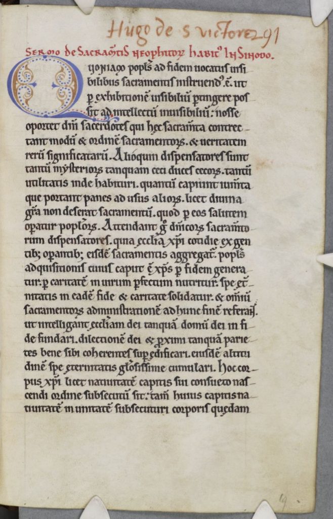
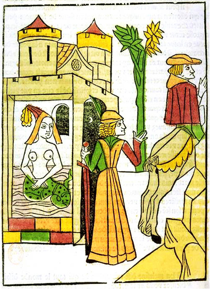
Cambridge, Corpus Christi, Parker Library 289. Ivo of Chartres, Sermo de sacramentis neophitorum, here ascribed to Hugh of St. Victor. Images courtesy of The Parker Library, Corpus Christi College, Cambridge. Licensed under a Creative Commons Attribution-NonCommercial 4.0 International License.
The text most commonly cited in scholarly literature, and the one used in my translation of this homily, is that published by Jacques Paul Migne in Patrologia Latina vol. 162, which is in turn based on previous editions by Fronteau and Hittorp. Although I was not able to consult them within the scope of this project, more than seventy manuscripts survive that contain some or all of the homilies included in the Migne edition. The most important would be Chartres, Bibliothèque Municipal 138, which formerly belonged to Chartres Cathedral, but it was heavily damaged in the Allied bombing of the city during the Second World War and is now largely unreadable. The remaining manuscripts are distributed broadly across Western Europe, with large concentrations in the British Museum, various colleges in Oxford and Cambridge, the Bibliothèque Nationale in Paris, and the Vatican. A surprising number of the extant witnesses date to the twelfth century, suggesting that this collection became popular shortly after its creation. The collection as a whole, to the best of my knowledge, has never been translated into a modern language. This specific sermon, however, was partially translated in the late 1940s as part of a broader gathering of works from across the Patristic and Medieval homiletic tradition [3].
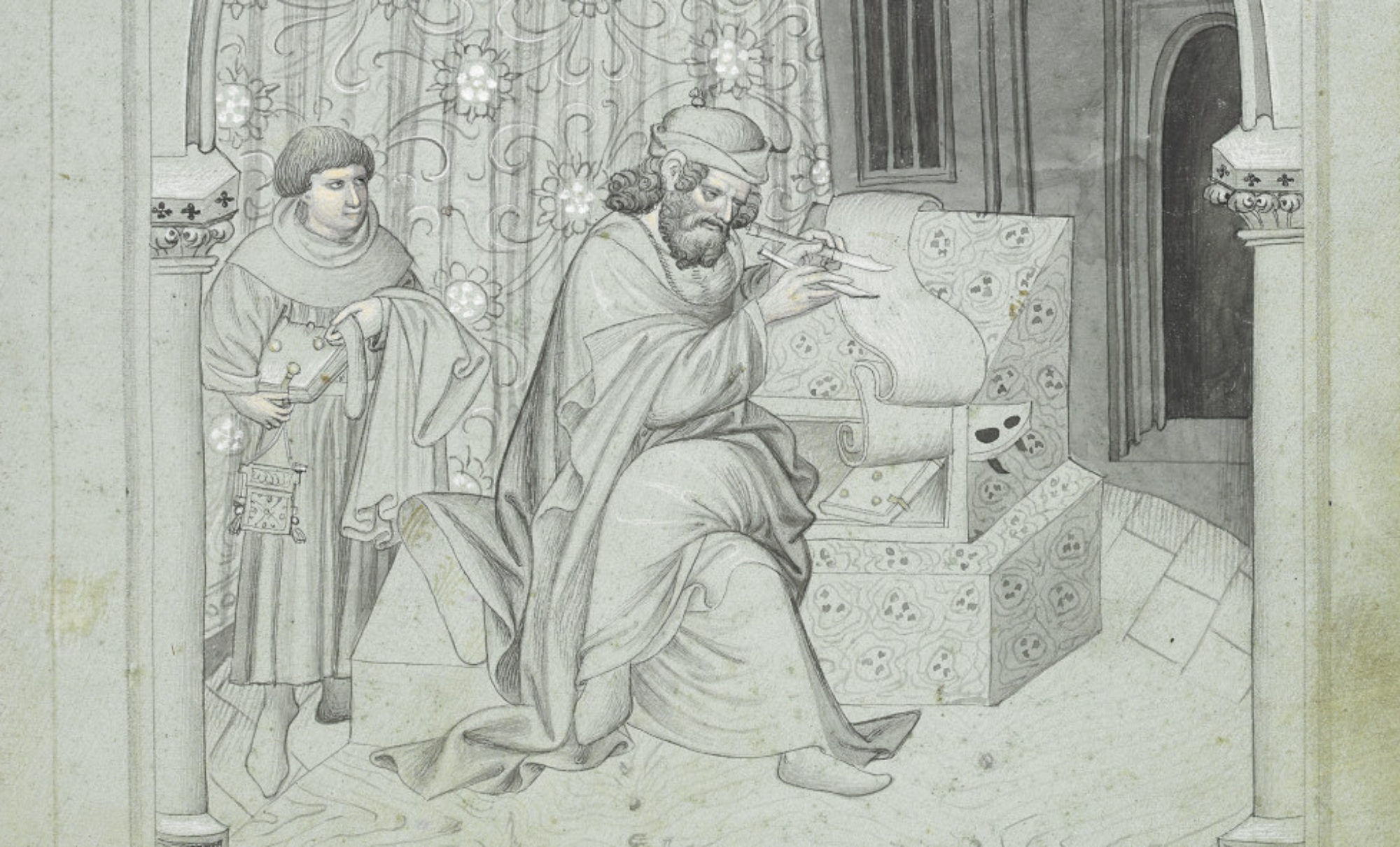
The homilies in Ivo’s collection fall broadly into two categories. The first, encompassing numbers 1–6 and 22–24, are essentially liturgical commentaries, offering detailed allegorical explorations of various rites (e.g., Sermo I, De sacramentis neophytorum), other incidental features (e.g., Sermo III, De significationibus indumentorum sacerdotium), or specific prayers (e.g., Sermo XXII, De Oratione Dominica) of the Church. The balance of the homilies are on the feasts of the church, beginning with Advent and working through the feasts of the Nativity, Circumcision, Epiphany, Purification (Candlemas), and the Lenten and Paschal cycles. The audience for some or all of these homilies appears to have been an assembly of the local clergy of Chartres: many of the manuscripts add the phrase “in synodo habitus” (something like “considered in synod”) to the titles of some of the texts, and even in the text below Ivo addresses his audience as “Your Fraternity,” strongly suggesting, at least to me, that he was speaking to other clerics [4].
The text presented below is the first of the festal homilies and discusses Advent, or, as Ivo insists, both Advents of Christ. The entirety of the work maintains a parallel structure, contrasting the first Advent, i.e., the earthly ministry of Christ, with the second, during which Christ will return as judge. Throughout, an emphasis is placed on the redemptive and restorative work that has already been accomplished during the “hidden” Advent, which prepares his audience for the completion of salvation in the second, “manifest,” coming.
Nick Kamas PhD in Medieval Studies University of Notre Dame
The most comprehensive study of Ivo of Chartres is by Rolf Sprandel, Ivo von Chartres und seine Stellung in der Kirchengeschichte (Stuttgart: Anton Hiersemann, 1962). His life is also occasionally discussed in other secondary literature, especially on Ivo as a canonist, e.g., Christof Rolker, Canon Law and the Letters of Ivo of Chartres (Cambridge: Cambridge University Press, 2009).
Roger Reynolds, “Liturgical Scholarship at the Time of the Investiture Controversy: Past Research and Future Opportunities,” The Harvard Theological Review, 71 (1978): 109–124).
Ray C. Petry, ed., No Uncertain Sound, Sermons that Shaped the Pulpit Tradition, (Philadelphia: The Westminster Press, 1948), 140–142.
Credit belongs to Margot Fassler for suggesting the setting for these homilies, The Virgin of Chartres (New Haven: Yale University Press, 2010), 136.
I recently gave a guest lecture during Dr. Megan Hall’s fall 2024 course entitled “Witches, Warriors, and Wonder Women: Women, Power, and Writing in History.” To prepare for my visit, students read excerpts from Jean d’Arras’s Melusine; Or, the Noble History of Lusignan as translated and edited by Donald Maddox and Sara Sturm-Maddox (Penn State UP, 2012). The story of Melusine, for those not in the know, is steeped in folklore. Various accounts of the tale involve a fairy woman named Melusine who takes on a half-serpent form from the waist down during part of the week and must hide this from her lover lest they suffer the consequences! Jean’s version of the tale, which dates to 1393, offers an account of the founding of the Lusignan dynasty and how Melusine, a half-fairy woman cursed to assume a half-serpent form on Saturdays, played a major role in its establishment and prestige. The House of Lusignan in its heyday counted Crusader kings among their ranks. My goals were to get Dr. Hall’s students thinking about the representation of non-humanness, the ways in which Melusine wields and exercises power, the significance of relating a historical family’s lineage to a fairy founder, and the truth claims that Jean makes. Certainly a tall order for our hour and fifteen minutes together, but trust me: the students rose to the occasion!
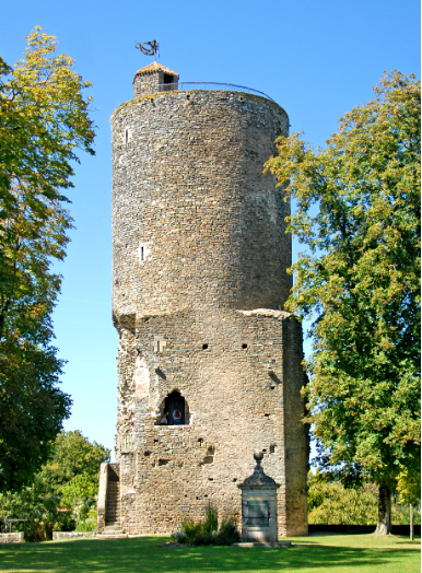
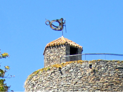
Tour Mélusine was built at the end of the 12th century/beginning of the 13th century to support the fortified town of Vouvant in western France. It is a vestige from when members of the House of Lusignan built a castle in the area.Legend has it that Melusine herself built the tower in a single night. (Right, close up) Note the weather vane at the top! It’s shaped like Melusine’s half-serpent form.
The text’s prologue immediately draws you into Jean’s narrative web. I find it striking how he claims to weave together various sources and reconciles them with his Latin Christian faith so that he can then go on and discuss Melusine. He references Aristotle and Saint Paul’s Epistle to the Romans in his discussion of marvels. Yet, he writes that “even those well versed in science can hear or see things they cannot believe but which are nonetheless true. I mention these matters because of the marvels that occur in the story I am about to tell you, as it pleased God my Creator and at the behest” of his patron, John, Duke of Berry (20). The marvels that Jean references, of course, are the ones associated with fairy magic and power. Fairies—and Jean references Gervase of Tilbury’s account of fairies for this portion of the prologue—can take on the form of beautiful human women. They can marry human men and even bear children with them, but these men must make promises to their fairy wives and uphold them. These promises can range from a prohibition from seeing the fairy wife nude to never seeing her in childbed.
According to Jean’s summary of Gervase, “[a]s long as these men kept their promises, they increased in rank and prosperity, but at the moment they broke them, they lost the women, and their fortunes slowly declined” (21). In a few short paragraphs, Jean not only tries to bolster the authority of his tale with these references to notable predecessors, but he also builds the world of fairies for his audience. Melusine then is but one example of how the marvel of fairies can operate, leading to some major consequences. As a class, we tried to make sense of Jean’s claims and how he reconciles fanciful fairy tales with what seemed like major authoritative sources. Surely, there must be something special about fairies—why else would Jean spend so much time insisting on their existence and the truth of the tale he is about to share? Furthermore, why would a powerful family like the Lusignans want to connect their family line to a fairy? After discussing the prologue, we were ready to tackle the rest of the text.
Raymond walks in on his wife, Melusine, in her bath and discovers she has the lower body of a serpent. Illustration from the Jean d’Arras work, Le livre de Mélusine (The Book of Melusine), 1478.
The tale unfolds as Jean recounts Melusine’s first encounter with her soon-to-be husband, Raymondin. Melusine’s enchanting beauty causes Raymondin to fall in love at first sight. The two marry under one important condition: that he never attempt to see her on Saturdays. Ever! Unbeknownst to Raymondin, on Saturdays Melusine keeps away from him and hides the fact that her lower half takes on a serpentine form. For years, they enjoy a prosperous marriage. They have numerous sons together, and the majority of them, according to Jean, go on to be rulers of Cyprus, Armenia, and more. Melusine takes on the role of master planner and architect. She builds fortresses and advises her husband on how to increase his wealth and prestige. This marital bliss, however, comes to an end when Raymondin spies on Melusine and discovers her Saturday secret. Though he keeps it to himself for some time, in a moment of anger he reveals knowledge of her weekly transformation and weaponizes it against her in an argument. Since he breaks his promise to her, Melusine takes leave of him. When his death nears, she returns in the form of a dragon.
Dr. Hall’s students truly impressed me with their thoughtful engagement with the text. We had conversations about female agency and power. I asked them to think about narratives parallels in the text and the role of curses and magic across similar events. I pointed out how when fairies and humans reproduce, their progeny bear remarkable physical features ranging from gigantism to having an unusual number of eyes. We pondered what a prestigious family like the Lusignans would gain from claiming a half-fairy woman as a major progenitor and have her powers be a major explanation for their wealth and prestige. I had so much fun diving in the text with them. It was clear to me that they had plenty to say about the ways in which the text represents various interpersonal dynamics. Melusine’s fairy qualities add to her allure and ability to influence those around her, for better or worse.
As our short time together came to an end, I asked them to think about Melusine’s legacy and afterlives. The legend of Melusine has endured and continued to captivate over the centuries. The major coffee chain Starbucks, for instance, has a rendition of Melusine as its logo (though the company’s own lore obscures this link!). For the jazz fans reading, please know that there is an incredible musician by the name of Cécile McLorin Salvant, whose seventh solo album, Mélusine, was released in March 2023. In the description for the album on the website Bandcamp[1] , Salvant unpacks the significance of the Melusine story and how it resonates with her.
Album art for Cécile McLorin Salvant’s Mélusine (2023).
What I find striking about Salvant’s reflections on the Melusine story is her reading of how significant gazes are. She shares that the tale is “also the story of the destructive power of the gaze. Raymondin’s sword pierces a hole into [Mélusine’s] iron door. His gaze does too. The gaze is transformative and combustible. She sees that he is secretly seeing her. Her secret is revealed. This double gaze turns her into a dragon.” Dr. Hall’s students definitely picked up on the power of the gaze but also recalled that it is a power that had to be weaponized before it could transform. In other words, when Raymondin first sees Melusine’s true form, he keeps his transgression to himself. His gaze is a breach of trust, and Melusine knows that her husband spied on her but decides to forgive him because he maintains her secret. However, when he becomes enraged, his anger causes him to lose all discretion. Raymondin angrily reveals that he knows about Melusine’s weekly transformations and resents her. The students recognized that it was precisely this resentment that made the revelation of the secret so powerful.
Another powerful way that Salvant relates to the Melusine story is through the idea of hybridity. Salvant was born in the United States to a French mother and a Haitian father. She spent ample time studying music in Aix-en-Provence, France. She is intimately familiar with negotiating various languages and cultures. When discussing the album Mélusine, she says it is “partly about that feeling of being a hybrid, a mixture of different cultures.” Though we did not get ample time to discuss Salvant’s feeling of hybridity, I do love how she draws a connection between her experiences and that of the legendary Melusine, who also had to navigate different cultures and human/non-human experiences. I find it beautiful that the tale of Melusine endures after all this time and can inspire people to explore the intersections of their own identity and reflect on how they experience the world.
While students were packing up their bags and heading out the door, one student lingered behind and wanted to keep the conversation going. This student wanted to talk about how Melusine’s representation of fairies as having conflict with God struck them; in their culture, fairies and even gnomes are guardians and protectors. The enthusiasm that the student exuded was infectious! And reflecting on this moment now, this just speaks even more to the allure not just of Melusine but of the magical realm at large: a space of play and imagination, sure, but also of power relations, of fidelity, of exploring identity, and so much more.
Anne Le, Ph.D. Public Humanities Postdoctoral Fellow Medieval Institute University of Notre Dame
In my recent blog discussing a new form of theatrical medievalism in which I have become immersed—allowing me both a creative and intellectual outlet—I centered my discussion on my creative direction and process and how my studies in medieval literature informed my directive style at two local Renaissance Faires in North Central Massachusetts which I was involved with managing, organizing and directing, Wyndonshire Renaissance Faire at the Community Park in Winchendon, MA and Enchanted Orchard Renaissance Faire at Red Apple Farm in Phillipston, MA. Wyndonshire, the first of these faires, will be the center of my discussion today as I explore the way this project engaged local performers, vendors and community members who came together to cocreate an event that revitalized the town and region. It was also a lot of fun, especially when it all came together on the final weekend in April last year.
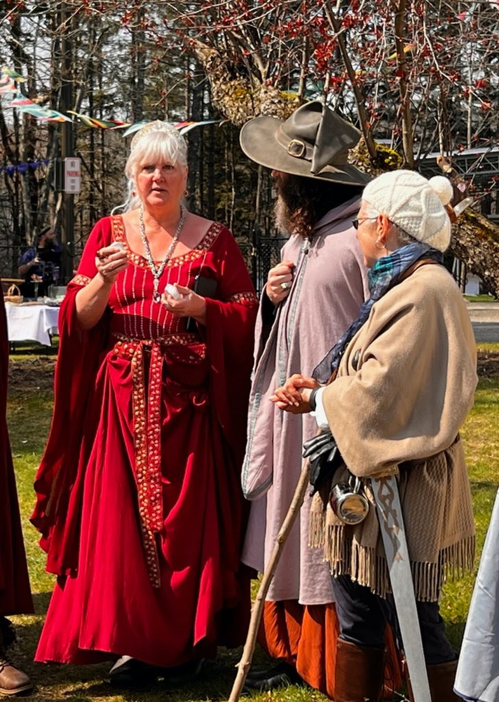
Crimson Countess (Dawn Higgins), Wizard of Wyndonshire (Richard Fahey), and Sir Joan (Kellie Carter); Image by Richard Carter (April 28, 2024).
Wyndonshire began with an idea proposed by Parks and Recreation Member Dawn Higgins, who championed the initiative and served as RenFaire Coordinator this past year, helping coordinate costume clinics for character actors with Costume Coordinator, Ashley Rust, and vendors with then Park and Recreation Coordinator, Tiffany Newton. My wife, Rajuli Fahey, and I joined on as community members and part of the Planning Group for Winchendon’s RenFaire initiative, but came to wear many hats and serve in numerous roles, including as Creative, Theatrical and Entertainment Directors. Well before directing and academic consulting, I began with world-building a fantasy kingdom, drawing inspiration from town history, and applying my knowledge of medieval culture and lore to imbue the scripts I created as Wyndonshire Playwright. I drew also from my studies and love of medievalism in considering the audience and to both appeal to and surprise patrons. And, as mentioned in my previous blog, I modeled my approach in part on the aesthetic of wonder operative in many of my favorite works of medieval literature.
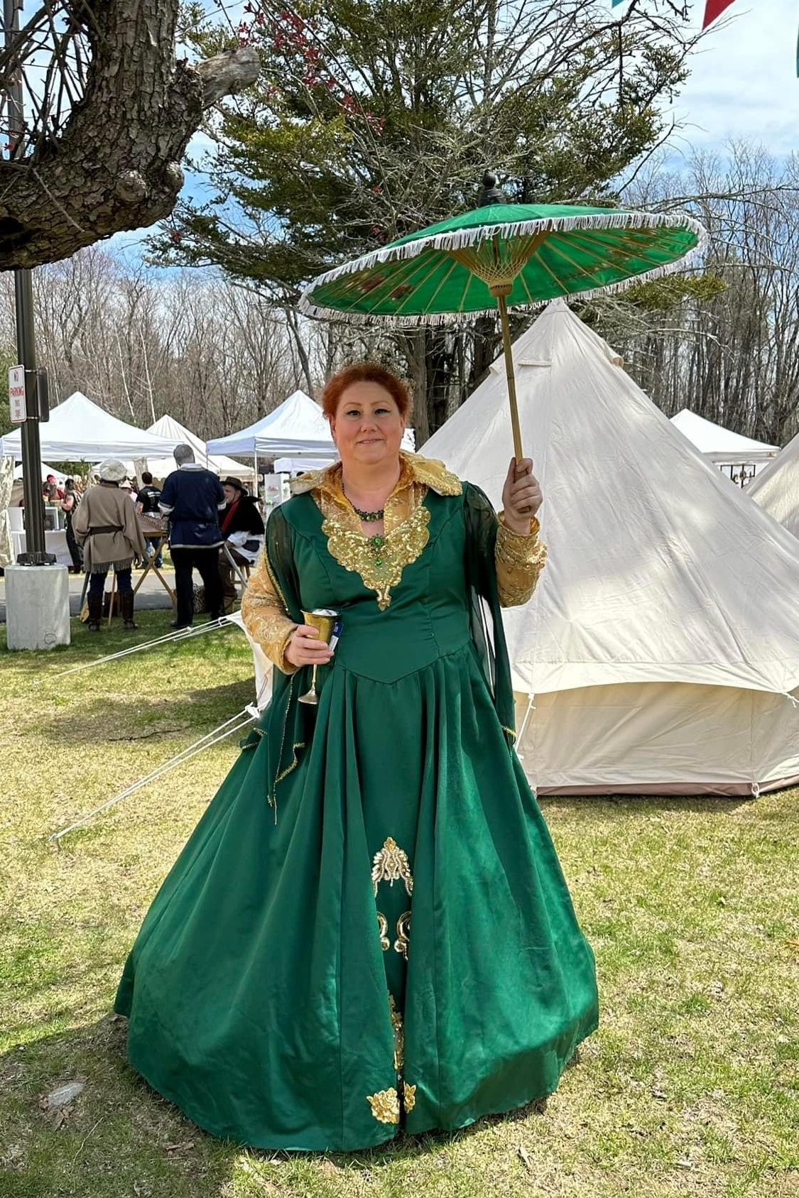
Green Queen of Wyndonshire (Tammy Dykstra); Image by Kit Catlett (April 27, 2024).
Creating the characters was a blast. I conceived of three main houses, and three primary nobles vying for power: the Blue King (James Higgins), the Green Queen (Tammy Dykstra), and the Red Baron (Dave Fournier). Rajuli created the graphic art for Wyndonshire, and she suggested noble family’s crest included a local animal as a sigil, so we chose the stag for the king, the otter for the queen and the fox for the baron. I also created a host of characters to populate the kingdom: townsfolk, rogues, pirates, vikings, knights, ministers, and additional nobility. There are also wondrous creatures from literature, myth and legend: fairies, merfolk, witches and sirens. Of course, this conglomerate of fictitious characters borrows from medieval and modern traditions, and reaches into the realm of the imaginary. Wyndonshire can only be described as a historical and literary anachronism and amalgamation. In this way, this faire is full fantasy, designed to appeal broadly to audiences interested in premodern and early modern times or their perception of those earlier historical periods. In other words, designed to meet the expectations of those who would typically attend a modern Renaissance Faire.
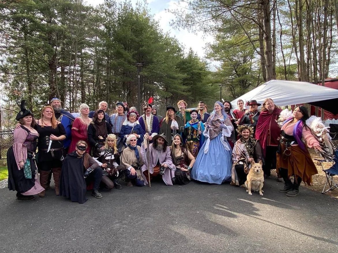
Wyndonshire cast: Pirate Queen (Katharine Taylor), Robber Baroness (Micayla Sullivan), Blue King (James Higgins), Crimson Countess (Dawn Higgins), Masked Bandit (Mitch Lang), Hooded Rogue (Mandalina Blake), Captain of the Kingsguard (Richard Carter), Fay Rogue (Noodle Doodle), Pirate Quartermaster (Jarod Tavares), Blue Champion (David Geary), Blue Duke (Bill Evans), Blue Duchess (Lori Evans), Kingsguard (Kellie Carter), Herald (Alex Deschenes), Red Champion (Cameron Hardy), Wizard (Richard Fahey), Enchantress (Rajuli Fahey), Sheriff of Shirewood (Jennifer MacLean), Queensguard (Nikolaus Brauer-Chagnon), Jester (Chelsey Patriss), Kingsguard (Ayden Mel), Blue Princess (Melanie “Melegie” Lemony), Baronsguard (Dan Towle), Baron’s Hand (Devon Barker), Fairy Prince (Sasha Khetarpal-Vasser), Red Baron (Dave Fournier), Red Duke (Michael Bearce), Siren (Jessa Funa); Image by Keith Fisher (April 28, 2024).
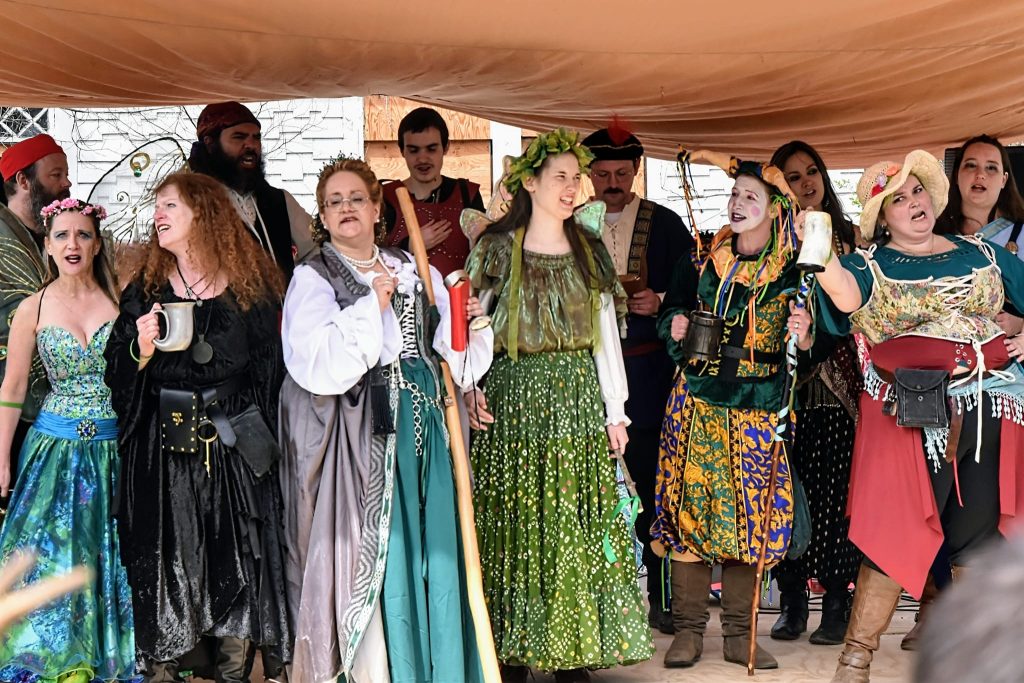
It was at this point that magic truly began happening, and it came from the local community. At our auditions, the synergy was palpable—dozens of folks came out to try and embody one of my characters or contribute their creative touch to this growing community project. There were people from different backgrounds coming together to cocreate immersive theater—some folks were part of community theater productions, others were veteran “Rennies” and even Dungeons & Dragons roleplaying groups got involved. Everyone rose up and became a creative team. One example of many was the work of Tammy Dykstra, who was cast as the Green Queen, and later stepped into the role of Music Director, taking on a group of singers, with a spectrum of training and experience. Assisted by Planning Group member, Jacque Ellis, Tammy and the Wyndonshire Singers produced a masterful “pub sing” that was engaging for both spectators and participants, and provided some ribaldry, entertainment and comic relief against a plot that was otherwise often grim and tragic.
Wyndonshire Pub Sing: Pirate Boatswain (Merill Blake), Fairy (Jodi Schoolcraft), Weird Sister (Siobhan Doherty), Pirate Quartermaster (Jarod Tavares), Green Duchess (Jen Knight), Baron’s Hand (Devon Barker), Herald (Alex Deschenes), Jester (Chelsey Patriss), Enchantress (Rajuli Fahey), Town Crier (Leanne Blake) & Shieldmaiden (Sylvia Sandridge); Image by Richard Carter (April 28, 2024).
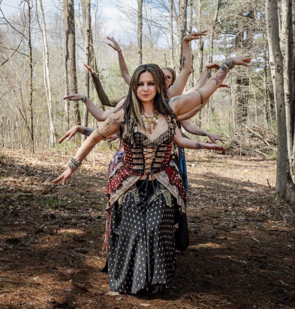
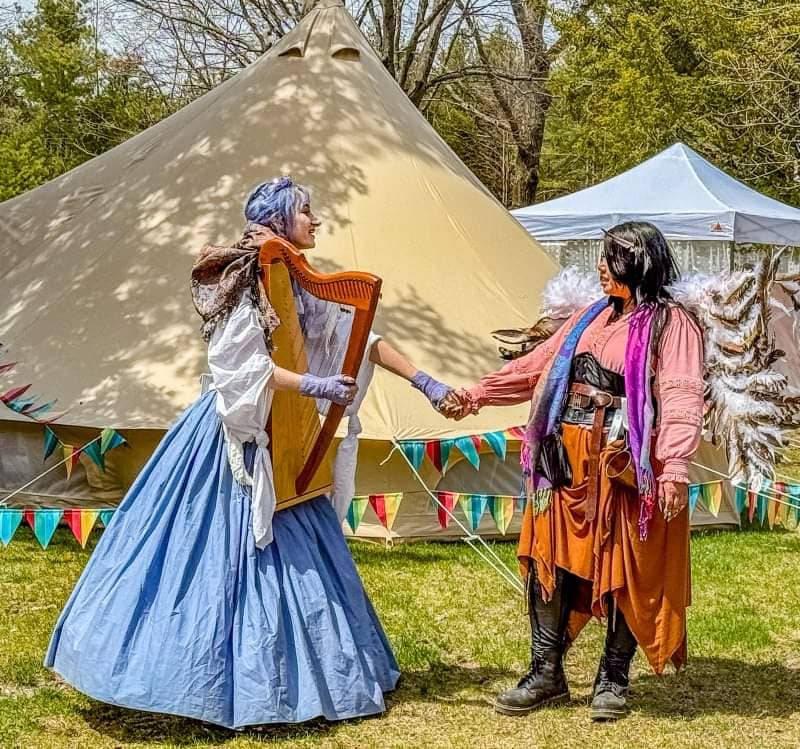
Wyndonshire Renaissance Faire also featured a Belly Dance showcase that paid homage to the evolution of American Belly Dance and American Renaissance Faires, organized through partnership between Rajuli, Rachel Moirae of Our Dance Space, and Cheryl Kalilia of PsyBEL. The showcase featured regional dancers with a variety of styles—some improvisational, some choreographed—all performing to music with live percussion accompaniment added by spectating dancers, performers and patrons, which highlighted the collaborative and community spirit of the faire. From there, Wyndonshire spiraled outward, as performers and vendors were reaching out looking to get involved in the expanding project.
Rajuli Fahey and Nagashri Dancers (including: Lauren Conrad, Kerri Plouffe, Destiny Young, Leah Cameron, and Erin Berndt), performing at Wyndonshire Renaissance Faire; Image by Chris Young (April 27, 2024).
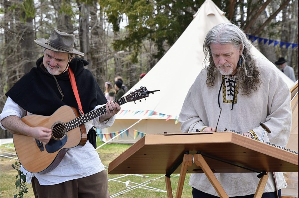
Misfits of Avalon performing at Wyndonshire Renaissance Faire. Image by Kit Catlett (April 27th, 2024).
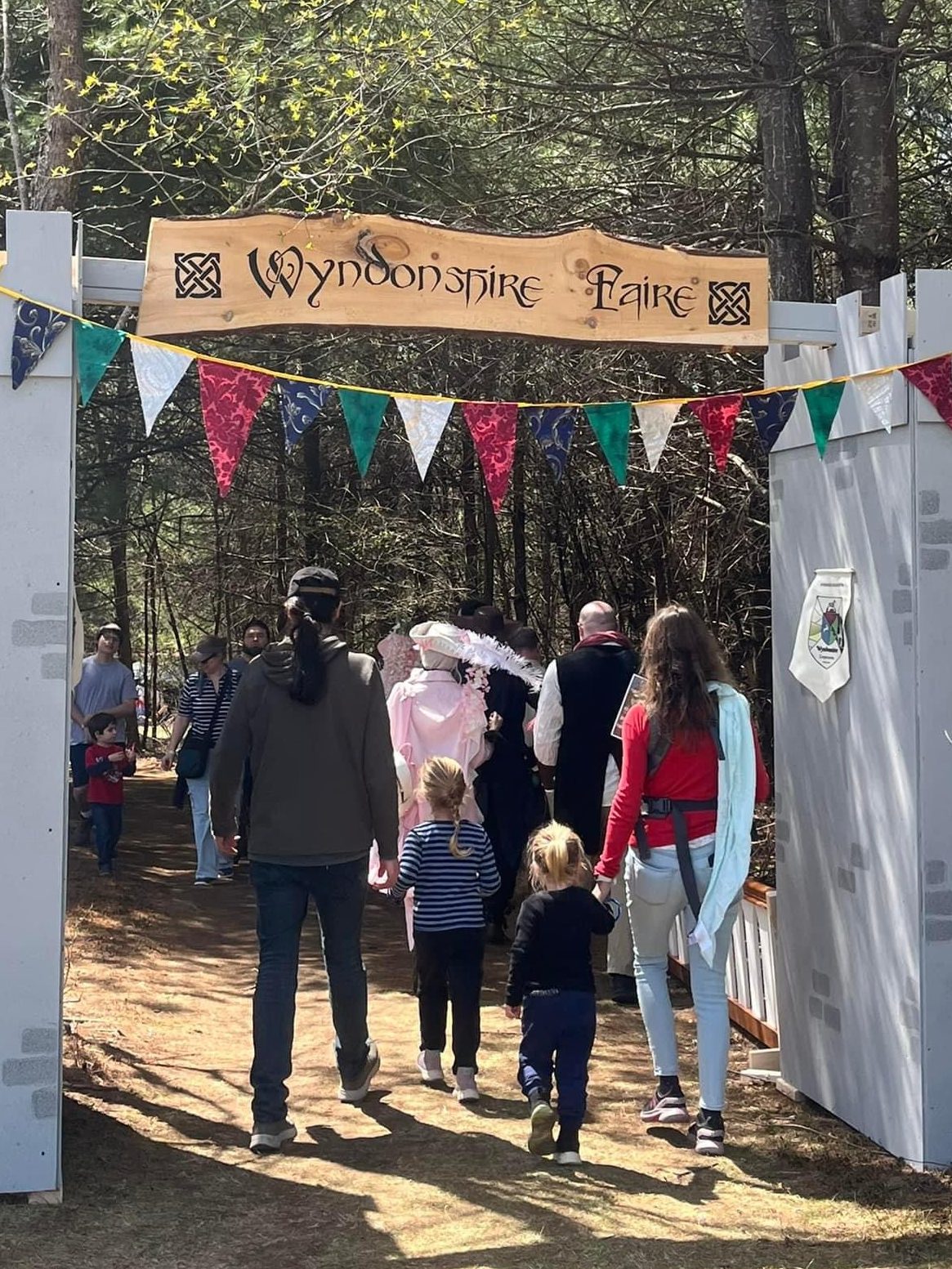
Signage was of course an essential element of the faire as well, both because signs add to the atmosphere and create the physical space, and because they helpfully direct patrons where to go. Another community member, Micayla Sullivan, who also played the Robber Baroness, took the lead on this and other crucial aspect of stagecraft as our “Sign Smith” along with a handful of other character actors. All the raw wood for the signs was donated from a local lumber company, Killay Timber Company in Royalston, MA, which made the production of Wyndonshire signage possible even without a budget. Similarly, local company, French Family Foundation in Winchendon, MA, donated lumber from local hardware store, Belletetes, to create the Wyndonshire gate, which James Higgins (who played the Blue King) and Dawn Higgins constructed for the event. Furthermore, local recording studio Blu3Kat Records volunteered to support the event’s sound management, and members from the local artist collective, Eldwood Council (especially Jacob Bohlen and Tom Fahey), partnered with FaeGuild Wonders, in order to create and build second main stage, the Mirage Stage, at Wyndonshire Renaissance Faire.
Wyndonshire Gate, sign by Micayla Sullivan; Image by Richard Fahey (April 28, 2024).
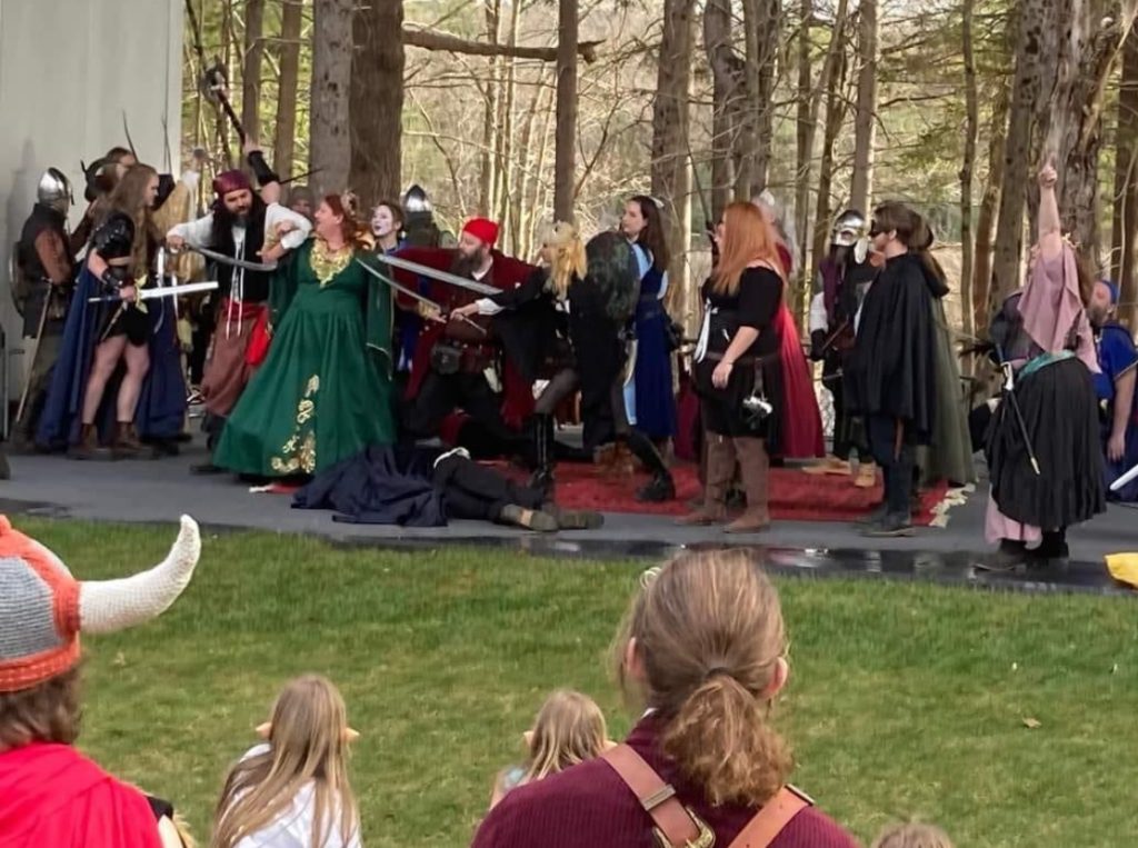
As performers and vendors were signing up to be part of the Wyndonshire, characters deepened and developed alongside and in tandem with my scripting. The first act of this faire, which will run one more year (June 21-22, 2025), involves conflict between the Blue King and the Green Queen for sway over the realm of Wyndonshire, with the Red Baron biding his time and waiting for any opportunity to climb into greater power. To avoid open war, in an attempt at “peace-weaving” if you will, the Blue King offers his daughter’s hand in marriage to the Green Queen’s son, thereby uniting the realm and settling the question of authority. Of course, each noble is still plotting their opponent’s’ demise, as the game of thrones continues subversively, and breaks out at the wedding feast, resulting in usurpation and regicide.
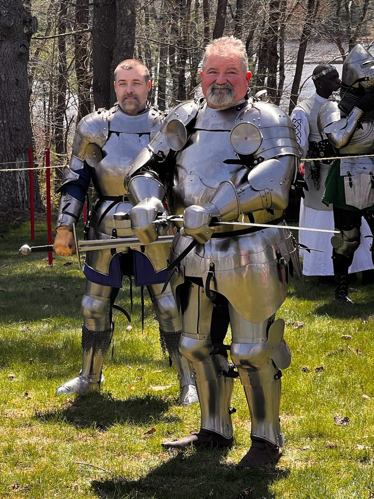
Knight of Lord Talbot: Blue Champion (David Geary), Green Champion (Frank Walker), Master of Arms (Kieth Fisher) & Red Champion (Cameron Hardy); Image by Richard Fahey (April 28, 2024).
In order to achieve the action scene in a manner that was safe and professional, we called upon the expertise of Frank Walker (Green Champion) who embraced the role of Combat Coordinator and worked out the staged combat with his historical reenactment group, The Knights of Lord Talbot, and in particular David Geary (Blue Champion) and Cameron Hardy (Red Champion), who were also performing combat demonstrations and facilitating a tournament of champions with historical weaponry and armor earlier in the day. Needless to say, this dramatically enhanced the plot and overall theatrical delivery of the climactic scene, and highlights how it was not just the cast of character actors but also performing groups who were collaborating to produce the drama of the Wyndonshire Wedding.
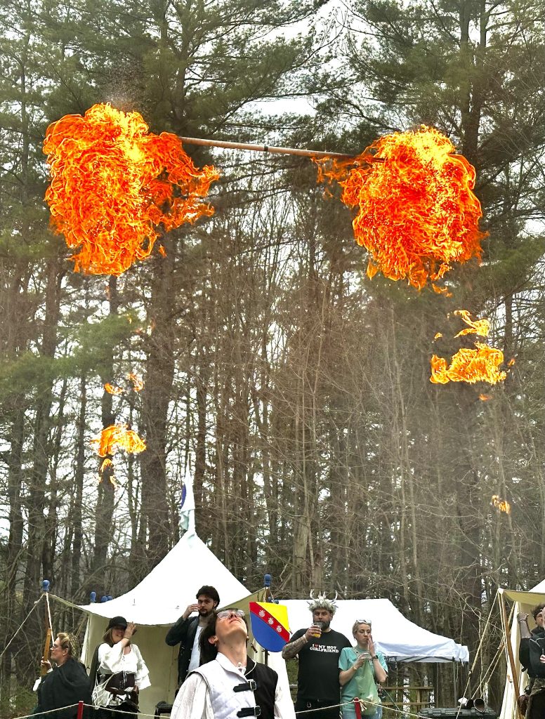
Phoenix Swords perform their fire show at Wyndonshire Renaissance Faire; Image by Phoenix Swords, (April 27, 2024).
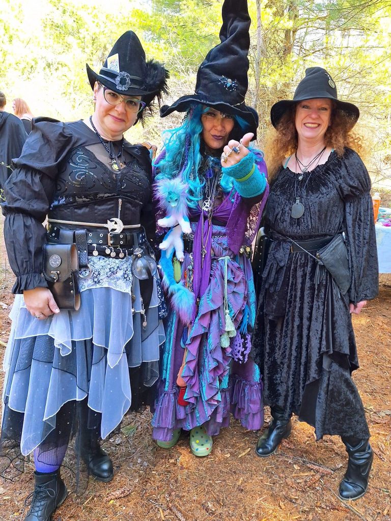
Some performing groups contained some scripted character actors that were part of the core cast. For example, the Mt. Wichusetts Witches came to Wyndonshire and set the stage for the carnage, and instrumental in twisting fate and turning the wheel of fortune. They contributed to the physical space by creating the Witches’ Den on the borders of the Faywood, where desperate Wyndonshire nobility come to make illicit pacts in service of their respective aims. The Mt. Wichusetts Witches, especially Wyndonshire’s Weird Sisters (Kate Saab, Chrissy Brady and Siobhan Doherty), who engaged in multiple immersive skits where they made magical bargains with representatives of the noble houses, culminating in a flash mob spell at the royal wedding that allowed the Green Prince (Drew Dias) to escape with the Fairy Prince (Sasha Khetarpal-Vasser) and the Blue Princess (Melanie “Melegie” Lemony) with the Siren (Jessa Funa), before smoke clears and the subsequent chaos erupts.
Weird Sisters of Wyndonshire: Trimmer (Kate Saab), Weaver (Chrissy Brady) & Spinner (Siobhan Doherty); Image by Richard Fahey (April 28, 2024).
But the regicide was not the end of the action. After the Green Queen seems to have consolidated power and claims unilateral victory, there is another surprise in store: a peasants revolt instigated by a rogue rebellion, overlooked by the Sheriff of Shirewood (Jennifer MacLean) and led by the Robber Baroness (Micayla Sullivan) with the Hooded Rogue (Mitch Lang), Masked Bandit (Mandaline Blake), the Pirate Queen (Katharine Taylor) with her Pirate Quartermaster [Jarod Tavares] and the Green Sash, led by Viking Jarl (Jason Sumrall) with his Berserker (Andrew Hamel), Shieldmaidens (Sylvia Sandridge, Sara Hulseberg, Ashley Sumrall & Gabrielle Emond) and Thanes (Gary Joiner, Daniel Berry, Jeffery Allen Evans, Matthew LeBlanc, Henry Peihong Tsai, Gavin Leo, Richard Sprusanky, Joshua Coffin, et al.).
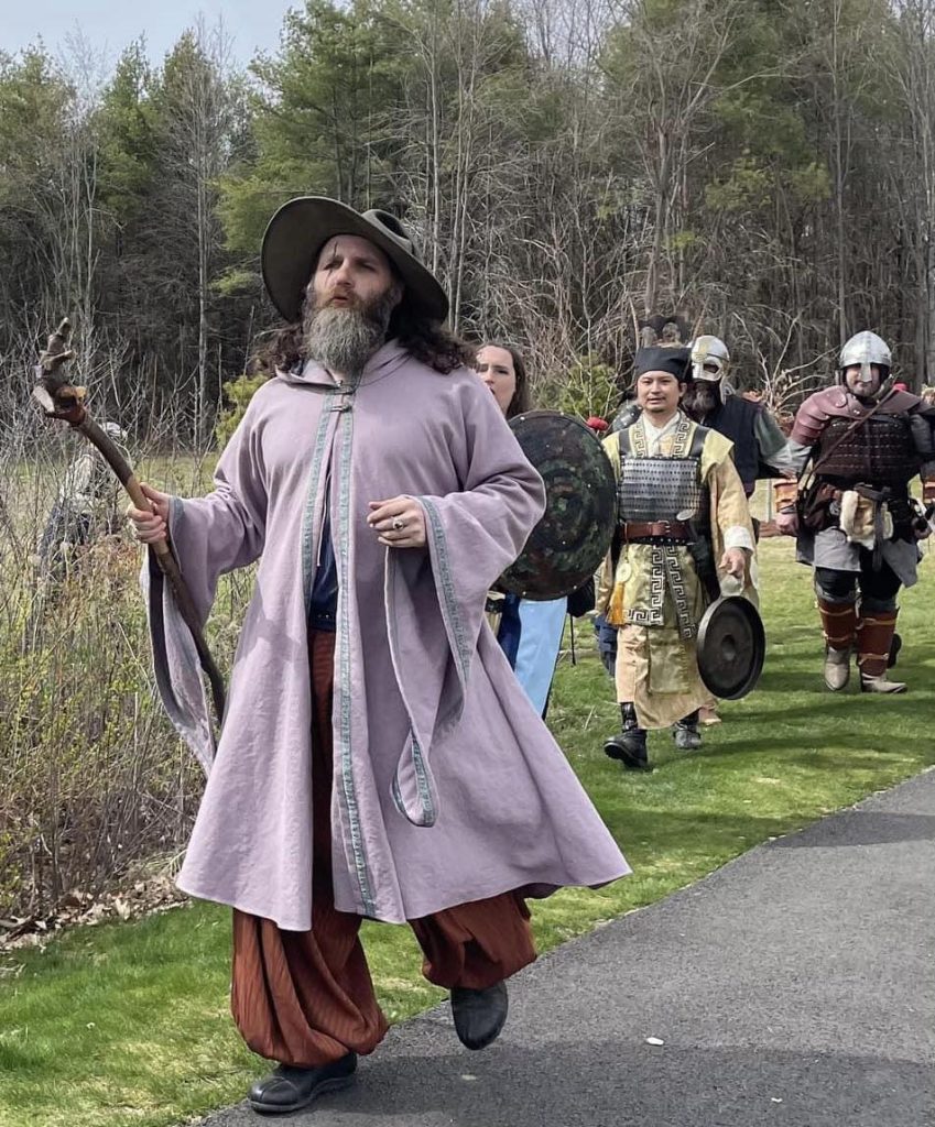
Wizard of Wyndonshire (Richard Fahey) leads a Viking Raid on Wyndonshire Town: Shieldmaiden (Sylvia Sandridge), Green Sash Thanes (Henry Peihong Tsai, Gary Joiner & Richard Sprusanky followed by others); Image by Adam Blake (April 27, 2024).
Indeed, The Green Sash, a “live history” and historical reenactment group (organized by Jason Sumrall) built and became our Viking settlement at the RenFaire. This group not only helped build the world of Wyndonshire, but like The Knights of Lord Talbot and Mt. Wichusetts Witches, The Green Sash became an integral part of the plot and interwoven into the story, contributing numerous immersive theatrical skits throughout the event, including singing and raiding Wyndonshire Town with the Wizard, conspiring with rogues and pirates to overthrow the nobility, and ultimately aiding the people’s revolution at the conclusion of the faire.
Wyndonshire Peasant Revolt overthrowing the Green Queen (Tammy Dykstra); Image by Richard Fahey (April 27, 2024).
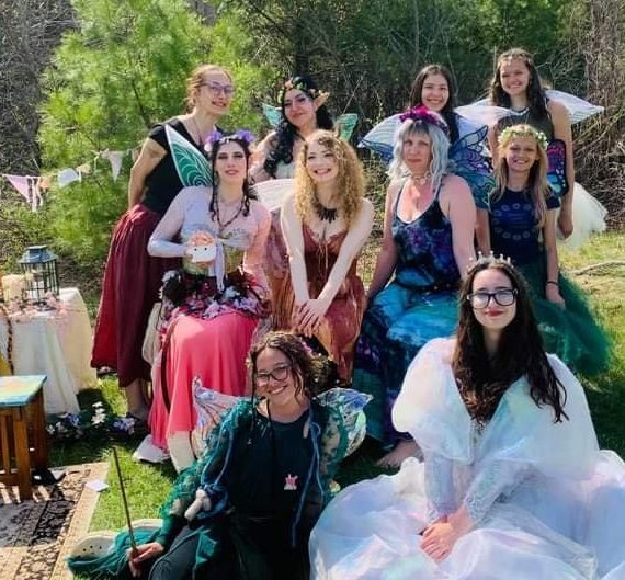
Another interwoven subplot at Wyndonshire involved the misadventures of the Fairy Court in the Faywood, which was primarily organized by Amy Boscho in partnership with Emilie Davis and many others. Amy is a local business owner and community member who was also part of the Planning Group for the faire, and she both directed the immersive theatrics surrounding the Fairy Court and coordinated the vendors at the Fay Marketplace in the Fairy Grove near Wyndonshire Gate. Moreover, to further develop the mythic elements near Faywood, professional mermaids, led by Tolkien scholar, Shae Rossi, adorned the shore of the nearby pond at the Winchendon Community Park.
Fairy Court in the Faywood of Wyndonshire: Amy Boscho, Jessica Mcmenamin, Sarai Sylvestri, Summer Skye, Emilie Davis, et al.; Image by Adam Blake (April 27, 2024).
By the end of the process, almost every character was cocreating at some level with the actor playing them, and in one case, one of the character actors, Jessa Funa, (who played the Siren character) even collaborated with me on an immersive subplot centered on fairy romance between herself and the Blue Princess. The sheer extent of community contributions to this event was truly incredible and has inspired me to interlace the storyline of Wyndonshire with its sister faire, so the two plots will interact and events at Wyndonshire will ultimately affect the fate of Enchanted Orchard. A project of this scope and magnitude takes a team—a village—and I am honored to be part of such a collaborative community, now FaeGuild Wonders, which was inspired to participate in a this exciting form of public medievalism.
Blue Princess (Melanie “Melegie” Lemony) & The Siren (Jessa); Image by Mitch Grosky (April 27, 2024).
Additionally, Park and Recreation Chair, Deb Bradley stepped up when the faire needed a liaison, and served as a stage manager during the event, a second representative from the Winchendon Park and Recreation Commission who played a critical role in the planning and operations of the faire. And, Red Apple Farm partnered in advertising the event and as one of the major food vendor, providing standard RenFaire snacks and specialty cider imported from the neighboring agrarian realm of Enchanted Orchard.
Although Wyndonshire did not return for 2025, I am optimistic that it will have a triumphant return in 2026.
Wyndonshire Crest depicting the sigils and colors of the three high nobles; Graphic Art by Rajuli Fahey (2024).
Richard Fahey Ph.D. in English Medieval Institute University of Notre Dame
Creative, Entertainment & Theatrical Director Playwright & Academic Consultant Wyndonshire Renaissance Faire (2024)