Why Fortify?  A Short Introduction to Four Byzantine Fortifications in the Maeander Valley

I chose these four fortresses as representations of the observable differences between Byzantine fortified sites.  Not all fortifications were made equal.  Differences lie not only in the choice of how walls and towers are constructed, but also in the placement of these fortified sites in the landscape.  Careful analysis of these features can reveal the underlying assumptions and motivations of the builders.  I have chosen among these four fortifications a military base, a refuge, a center for agricultural exploitation, and a fortified residence within the Maeander River valley.
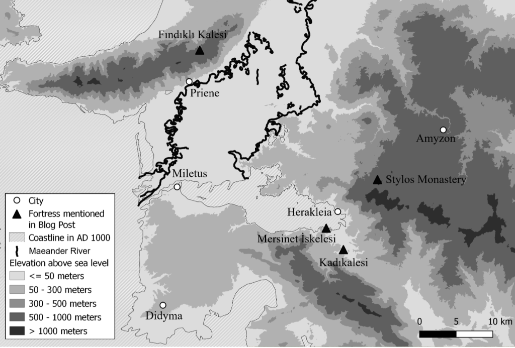
The Locations of the Fortresses, made by author in QGIS.

Kadıkalesi[1]

Kadıkalesi is a great example of a military fortress likely built and used by the Byzantine armed forces.  The entrances, not just the main one but the two postern entrances too, had a bent gate, which denies an attacker a good view inside the fortress (see Figure 2).  The towers project from the walls and include a larger circular tower which is more resilient to projectiles than a square tower.  Throughout the entire circuit of walls, platforms known as battlements were built for soldiers to be able to view the landscape.  The walls were caped with crenulations, which provided coverage for those soldiers from fire from below (see Figure 3).  This fortress was found on a small hill above a road, about 50 meters above sea level.  On the one hand, this elevation gave the soldiers good visibility of the surrounding countryside, but, on the other, it was low enough that the soldiers could quickly do something about a threat (see Figure 2). 
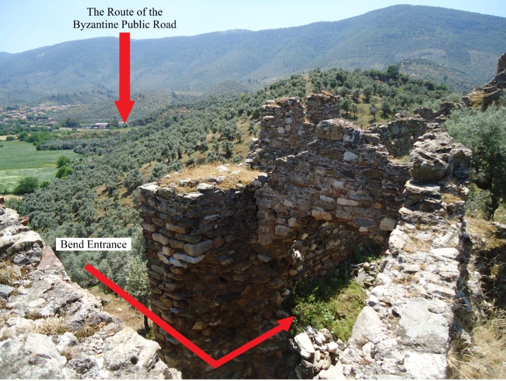
The Bent Gate of Kadıkalesi, photo by author.
The Battlements of Kadıkalesi, photo by author.

Fındıklı Kalesi[2]

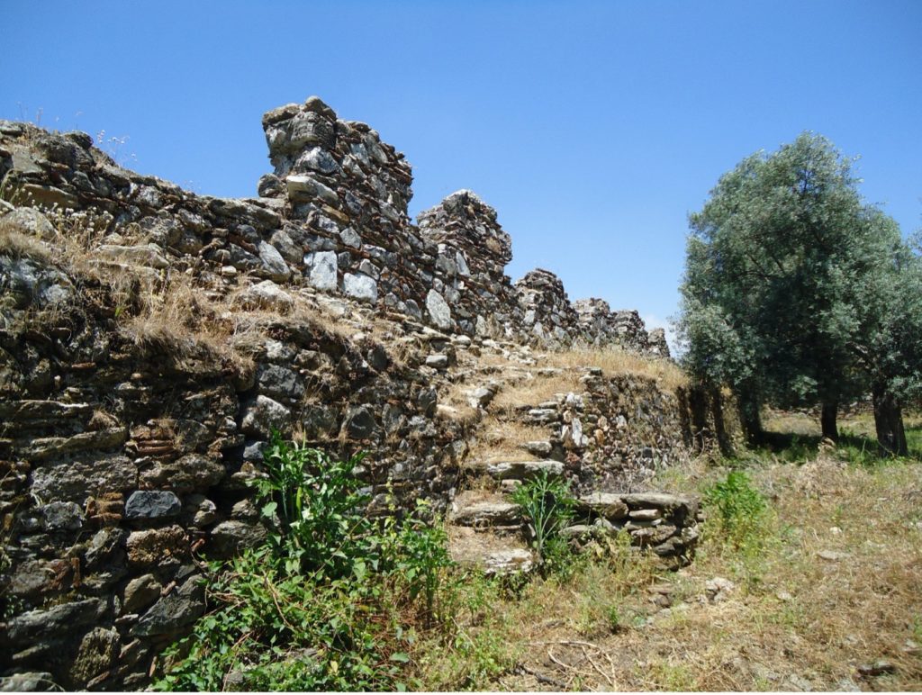
Fındıklı Kalesi was a large fortress on the top of a mountain, enclosing an area of seven hectares at an elevation higher than 600 meters above sea level.  Like Kadıkalesi, the walls were built with military concerns in mind; a series of towers and periodic battlements defend the portions of wall spanning the gaps between rocks, while a double gate fortifies the most vulnerable part of the fortress in the southeast.  The size of the fortress was partly determined by geology; the walls follow the edges of a massive rock outcropping.  Unlike Kadıkalesi, however, the fortress was isolated from the Byzantine roads that cross the mountain and unable to serve in the policing of routes.  I agree with scholars who see Fındıklı Kalesi as a refuge for times of invasion with only a small permanent peacetime population.[3]  This was a fortress, not of lords or soldiers, but of farmers and shepherds, who needed its great size to house flocks of sheep and its isolated location to keep just far enough away from any potential raiders that this ‘bluff in stone’ may appear like a formidable military fortress. 
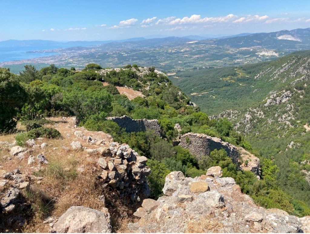
View North from Inside Fındıklı Kalesi, photo by author.

Mersinet İskelesi[4]

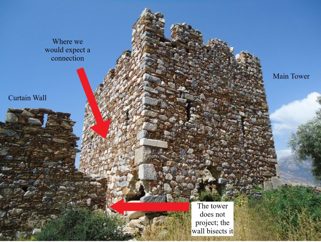
The impressive fortress found on the southern coast of Lake Bafa appears to be a military fort like Kadıkalesi.  The use of blind arches to support the battlements even shows an improvement over the thick walls of Kadıkalesi.  However, I argue that military effectiveness was not the main concern of this fortress.  The defining element of the fortress is a great tower bisected by the enceinte wall.  However, there is no communication between the walls and the tower; anyone stationed in the tower could not advance into the battlements in response to a threat.  Second, the tower does not protrude from the wall, which decreased its visibility and potential range of fire.  While Mersinet İskelesi’s position does provide a good view of the eastern half of Lake Bafa, nearby hills could provide a better view.  Instead, this fortress has more in common with the isolated towers found around Lake Bafa and in the wider Maeander Valley.  Mersinet İskelesi is an isolated tower with an increased budget.  I suspect that this fortress and the other towers have something to do with the exploitation of agricultural estates as these towers lie at the edge of the most plentiful area of farmable land adjacent to Lake Bafa, even if this fortress is usually interpreted as a fortified monastery[5] or military base.[6] 
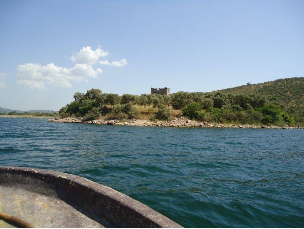
View of Tower of Mersinet İskelesi from Lake Bafa, photo by author.
Central Tower of Mersinet İskelesi from inside the Fortress, photo by author.

The Monastery of Stylos[7]

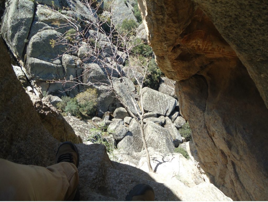
The final fortress is the monastery of Stylos.  Its walls aided the defense of a community which resided in isolated places like a type of fortified residence.  However, this monastery was never intended to operate like a military fortress.  For instance, the battlements were limited to walls located at known entrances on the north and south side.  They were only interested in watching visitors who intended to use a proper gate and not in observing the wider region.  Nor was it a refuge.  While the monastery was deep in its mountain like Fındıklı Kalesi, Stylos is near a branch of an ancient road network, which gives the monastery a greater ability to interact with others on and off the mountain.  Finally, the division of interior fortification betrays a uniquely monastic concern: the proper veneration of the founder of the monastery.  The inner bastion of the monastery contains the hermitage of Saint Paul the Younger cut in a tower of rock and decorated with a painted program of religious images (see Figures 6 and 7).  I suspect the fortification of the hermitage likely served to encourage the veneration of their founder and to connect that founder with the builder of the walls, likely Christodoulos of Latros who would go on to found the Monastery of Saint John the Theologian on Patmos.  Whatever the purpose of the inner gate was, it is hard to imagine it served the defense of the monastery. 
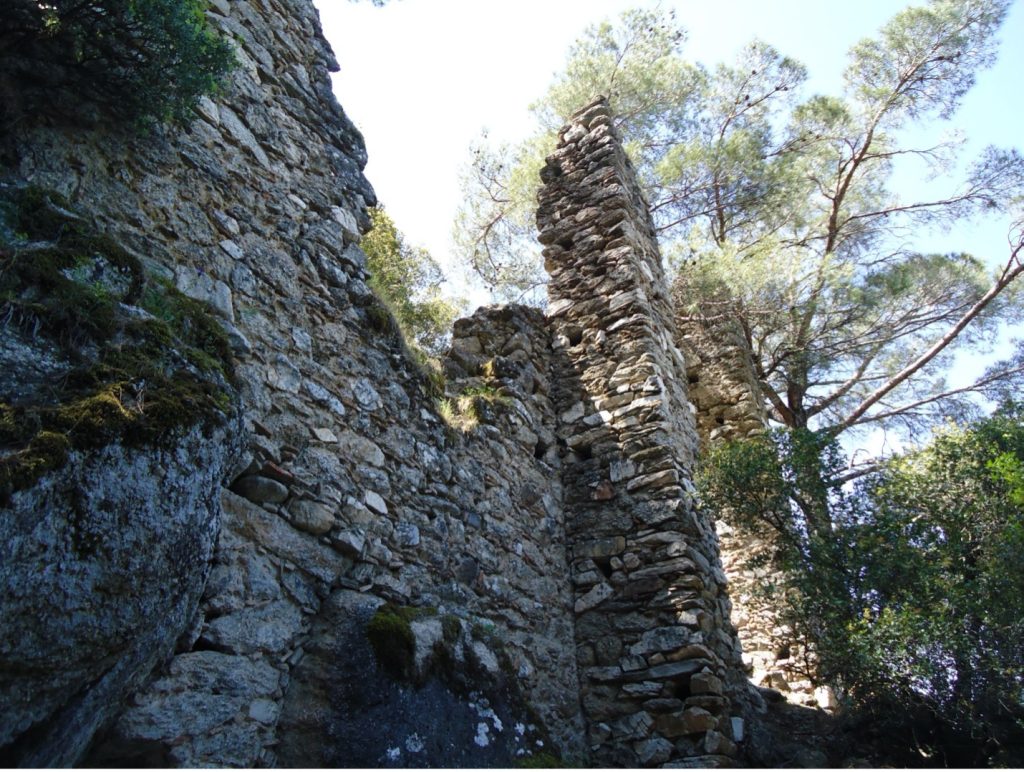
The Inner Gate of Stylos Leading to the Hermitage, photo by author.
View of the Hermitage of Saint Paul the Younger, photo by author.

Tyler Wolford, PhD
Byzantine Studies Postdoctoral Fellowship
Medieval Institute
University of Notre Dame


[1] Wolfgang Müller-Wiener, “Mittelalterliche Befestigungen im südlichen Jonien,” IstMitt 11 (1961): 19-23.

[2] Hans Lohmann et al., Survey in der Mykale 1, Bonn: Rudolf Habelt, 2014-2017, II.510-513 (MYK 65).

[3] Jesko Fildhuth, Das byzantinische Priene, Berlin: DAI, 2017, 96-98; for an opposing view see Lohmann et al., Survey in der Mykale, I.284-290.

[4] Müller-Wiener, “Mittelalterliche Befestigungen,” 17-19.

[5] Urs Peschlow, “Latmos,” Reallexikon zur byzantinischen Kunst 5 (1995): 695-696.  

[6] Müller-Wiener, “Mittelalterliche Befestigungen,” 18-19.

[7] Theodor Wiegand, Der Latmos, Milet III.1, Berlin: Georg Reimer, 1913, 61-72.

Bigger House: Cost of Living and Medieval Byzantium

Cost of living is a pressing issue faced by many people today. Inflation, gas prices, and housing costs all impact our quality of life. Recently these pressures have encouraged many people to move to areas where they hope to find better conditions. Large cities offer many conveniences. However, one’s home will not only be quite expensive, but also quite small. For the cost of a one bedroom condo in San Francisco, one could purchase a large house with a yard here in South Bend. Where one lives has a significant effect on the home they can have. This relationship between house size and location is not unique to today.

Those living in medieval Byzantium could not consult home listings from across the Empire. Nor was the freedom of movement that we have today in existence in the Middle Ages. However, there still existed significant variation in the size of village houses across regions. Villagers may not have simply been able to decide to move to an area that would provide their family with a larger house or greater resources, but clear differences in housing are preserved in the archaeological record.

Looking at the villages of the Byzantine Empire provides us with a fascinating glimpse of how location affected the houses of everyday people. Movement by villagers was restricted within Byzantium, but it did occur regularly. Most often this movement was spurred by necessity and not personal choice. After all, there was no simple way to compare houses from Anatolia and the Peloponnese. Further, the greatest impact on village houses was not the amount of money one could pay for them. The materials used to construct the house and local topography were the most significant factors. Most frequently, village houses were built by those who lived within them.

The physical location of one’s house would have a significant impact on its overall size. Often village houses were constructed on the slopes of hills or mountains. The steeper the incline, the smaller the house would be. Houses were most often rectangular in form and built perpendicular with the slope with the long sides of the house descending down slope. The short wall connecting these sides at the bottom of the slope served not just as a kind of retaining wall for the building, but needed to have a rather significant height in order to make a level platform for the second floor that was frequently included. If the incline on which the house was constructed was quite significant, this would limit the length that the house could be.

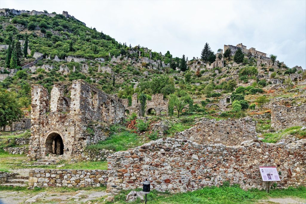
Holger Uwe Schmitt, The Byzantine ruined city of Mystras

For example, if the elevation along the slope changed by 5 meters after a 10 meter distance, then a house with 10 meter long walls would require a 5 meter high wall at the bottom in order to make a level area for second floor. That would be quite significant, and in some cases might be impossible to construct. Further, the short wall would need to be even higher to accommodate the height of the second floor and support the roof. A shorter house than would be required on the slope.

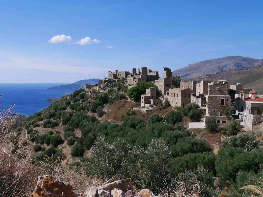
 Examples of how incline affects house size in the Byzantine village are found in the Mani peninsula. The Mani is the southernmost region of the Greek Peloponnese. The houses of the Byzantine village of Marathos are built along a steep mountainside. For the village of Sarania, the houses are built on a modest hill. While the houses of Marathos belong to a village that by all appearances had a longer and more prosperous life than Sarania, the houses here are generally smaller. In their original form, houses at Sarania are more than 10 m2 larger on average than houses at Marathos. Economic status of the settlements was not the determining factor in the size of the homes. Rather, it was topography that played the more significant role.

Camster, Modern village of Vathia in the Mani

In addition to their local topography, the physical material that houses were made from would impact their size as well. The houses of the Mani were built in the “megalithic” style. Large, roughly cut blocks of local limestone formed the walls of the house. Stone was even used to span the houses, forming support for additional floors or the roof. The use of stone for this purpose would limit the width of the village house. In theory, one could make their house as long as they wanted, but it would still be relatively narrow. Materials would limit size.

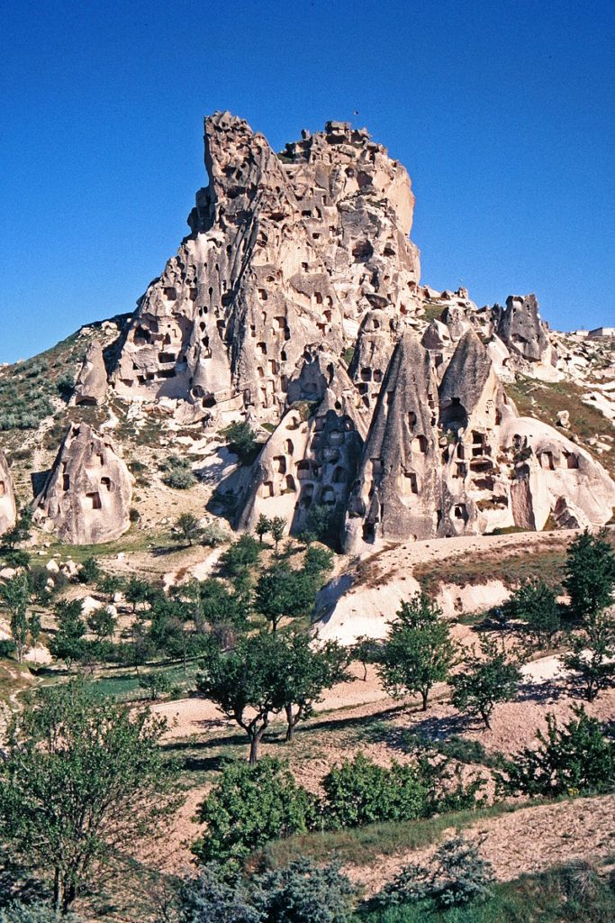
Moving across Byzantium to Cappadocia in central Anatolia, modern Turkey, we come to one of the most unique landscapes in the medieval world. Here, houses, churches, monasteries, and more are all carved into the volcanic rock of the region. Carving one’s house from stone would seemingly provide less limitations on the overall form and size. Building material did not need to be acquired and the physical limitations of built architecture were absent. There were other factors to consider however. While the volcanic stone of the region is considered soft as far as rock goes, it requires specialized tools and labor to carve. Different limitations then were placed on the houses of villagers here. It was not the building material that constrained the size of the houses, but the labor one could employ.

W. Bulach, Rock Carved settlement near Göreme in Cappadocia, Turkey

One can only imagine the thoughts that would go through the mind of a Byzantine villager who was able to observe the variation in housing within the Empire. How struck would they be by the different size of houses in one region compared to another? Would the rock carved homes of Cappadocia appear familiar or strange? Just as in the United States individuals working similar jobs can afford much different houses depending on their location, the housing of Byzantine villagers may be affected by similar dynamics. Other differences exist of course. Today, individuals working the same job may be paid differently based on where they live. However, anyone that has looked at house prices in the past year would see that these differences in pay are not proportional to the difference in the cost of housing. Villagers in one region of Byzantium may have had a better quality of life than those in another. The richness of Byzantine housing provides an important insight into these elements of daily life that reflect similarities of our experiences today.  

Mark James Pawlowski
Byzantine Studies Post-Doc
Medieval Institute
University of Notre Dame

Further Reading:

Pawlowski, Mark James. “Housing and the Village Landscape in the Byzantine Mani,” PhD Diss. (UCLA, 2019)

Ousterhout, Robert. Visualizing Community, Art, Material Culture, and Settlement in Byzantine Cappadocia (Washington D.C., 2017).

Bouras, C. 1983. Houses in Byzantium. Δελτίον τῆς Xριστιανικῆς ἀρχαιολογικῆς ἐταιρείας 11: 1-26

Medieval Chicago–In Gothic City: The Old Water Tower and Pumping Station, Part 2

Don’t forget to read Part 1 of this post first!

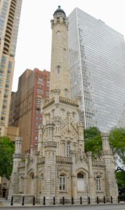
Full view of water tower. Photo by Karrie Fuller, copyright reserved.

The 19th-century preference for ornate, gothic structures indicates their admiration toward this formerly maligned medieval style, and it is within this context that William W. Boyington, his water tower, and many more of his buildings sit. However, architecturally speaking, Boyington’s tower has not always received great accolades for its artistry, tending to be revered as an engineering marvel instead. One guidebook, for instance, describes it as “stylistically naive,” stating that “Chicagoans are content to venerate it as a monument rather than criticize it as art” (Schultz 143). While emblematic of the neo-gothic style, this building might lack some of the aesthetic impact to which it aspires. His water tower and pumping station, therefore, represent his most famous, though perhaps not his most successful, attempt at integrating form and function in one building design. However lacking it might be in aesthetics, the tower’s medieval inspiration is impossible to miss. Although we tend to associate gothic architecture with cathedrals and religious buildings, this castle-like structure features a few of those classic gothic elements, particularly the pointed-arch windows and doors. Despite being dwarfed by its neighboring buildings, its central tower does imbue it with a sense of verticality, but without the heavy, looming presence of a cathedral or castle. The decorative gables and emphasis on geometric patterns also derive from the tower’s gothic influences, and its castle-like qualities are enhanced by turrets and battlements (for more information on gothic and neo-gothic architecture, see the bibliography below).

Boyington carried the gothic style he adopted over to other structures as well. The Rosehill Cemetery entrance, for instance, still stands, and had more of his buildings survived the Great Fire of 1871 as well as other ravages of time and human destruction, even more of his medieval-inspired buildings would continue to line the city streets. Luckily, records of some of these buildings do survive in drawings and photos archived and digitized as part of the Ryerson and Burnham Archives: Archival Image Collection by the Art Institute. A number of the buildings documented here also appear in the neo-gothic style.

Rosehill Cemetery maingate. Photo courtesy of Matt Hucke at Wikimedia Commons.

Looking at Boyington’s long list of architectural accomplishments, which extend beyond Chicago to places like Philadelphia and New York, one would be hard pressed to avoid the impression that this man built a great deal of Old Chicago and shaped its architectural character in ways that have persisted despite the domination of newer, taller structures over the city’s skyline (see Carbutt for a summary of his career). His wide-ranging work includes everything from the original trade building and the first University of Chicago to his many churches and even some residences. That his buildings appear in other major American cities also indicates a more widespread influence on the nation’s landscape. Although not the only player in the formation of Old Chicago’s appearance, perhaps one reason Boyington’s Water Tower maintains its status as a monument is that, despite its potential imperfections, it embodies so much of Chicago’s 19th-century values and priorities, both as a feat of architecture and engineering. It reflects, in other words, something essential to the original spirit of the city.

The Pumping Station. Photo by Karrie Fuller, copyright reserved.

Thus, while visually the water tower might stand out as an oddity in its current location, the building more than belongs here. It provides a snapshot of a once en vogue architectural style that imports elements of medieval European aesthetics and adapts them for new uses in a new world. It also serves as a reminder of how much effort Chicago, alongside many other major American cities, put into medievalizing the American landscape in order to establish a particular national identity. However, even though this movement drew upon the European heritage of citizens who themselves came from the families of European immigrants to the new world, it is worth acknowledging the global spread of the Revival as well as the Middle Eastern influences on the original medieval Gothic style. The “global Gothic,” as Jan Ziolkowski suggests, deserves attention because “for centuries, the style has been freighted wherever European culture and commodities have been carried” (148). Moreover, as scholars have long noted, Islamic architectural and artistic influences catalyzed the original shift from Romanesque (an early medieval architectural form based on classical forms) to what we have come to know as “Gothic” (Draper. See also Ziolkowski 108-9). The history of gothic building projects, then, derives from productive (though not easy) cross-cultural exchanges that altered the course of history and, literally, shaped how the world around us looks today. From Islam to Europe in the Middle ages, and from Europe to America in the 19th century, this chain of border-crossing artistic influence pinpoints an essential factor in understanding medieval Chicago’s reliance on forms imported, reimagined, and blended into new and original settings.

Today, this historic landmark and popular tourist destination houses the City Gallery in the Historic Water Tower, showcasing the work of local artists, photographers, and filmmakers. The neighboring pumping station now contains a public library and theatre. Michigan Ave has no shortage of great shopping and entertainment, but the tower is worth a quick stop next time you visit the Mile, providing a moment of historical enrichment to break up the street’s commercialism.

As a medievalist, I feel rather drawn to the Gothic Revivalist sentiments embodied in the Water Tower, and learning about this building and its historical influences has opened up a new way of viewing the Middle Ages through a time period well outside of my own academic specialization. I will not be at all surprised should Boyington’s name pop up again while working on this series; in fact, I hope it does. But learning about the Gothic Revival has also sparked my interest in a subdivision of this movement found in the “Skyscraper Gothic” style that will more than likely lead me the Chicago Tribune Tower as we explore this gothic city.

Karrie Fuller, PhD
University of Notre Dame

Online Resources:

“Boyington, William W.,” Ryerson and Burnham Archives: Archival Image Collection, TheArt Institute of Chicago, accessed on November 1, 2018, http://digital-libraries.saic.edu/cdm/search/collection/mqc/searchterm/Boyington,%20William%20W./mode/exact.

Gale, Neil. “The History of the Chicago Water Tower,” The Digital Research Library of Illinois History Journal, published on December 3, 2016, https://drloihjournal.blogspot.com/2016/12/chicago-water-tower-history.html.

“Illinois SP Chicago Avenue Water Tower and Pumping Station,” National Register of Historic Places, National Archives Catalog, National Park Service, accessed on October 19, 2018, https://catalog.archives.gov/id/28892376.

Leroux, Charles. “The Chicago Water Tower,” Chicago Tribune, published on December 18, 2007, http://www.chicagotribune.com/news/nationworld/politics/chi-chicagodays-watertower-story-story.html.

“Throwback Thursday: Chicago Water Tower Edition,” Chicago Architecture, Artefaqs Corporation, published on March 5, 2015, https://www.chicagoarchitecture.org/2015/03/05/throwback-thursday-chicago-water-tower-edition/.

Works Cited & Further Reading

Blackman, Joni Hirsch. This Used to Be Chicago. St. Louis, MO: Reedy Press, 2017.

Carbutt, John. Biographical Sketches of the Leading Men of Chicago, 215-22 . Chicago: Wilson & St. Clair, 1868. [Written in a dated style, this book is florid, grandiose, and male-centric, but contains some useful information about Boyington nevertheless.]

Draper, Peter. “Islam and the West: The Early Use of the Pointed Arch Revisited.” Architectural History48 (2005): 1-20.

Frankl, Paul. Gothic Architecture. Revised by Paul Crossley. New Haven: Yale University Press, 1962, 2000.

Grodecki, Louis. Gothic Architecture. New York: Electa/Rizzoli, 1978.

Murphy, Kevin D. and Lisa Reilly. “Gothic.” In Medievalism: Key Critical Terms, 87-96. New York: Boydell and Brewer, 2014.

Oxford English Dictionary, s.v. “Gothic,” accessed September 20, 2018, http://www.oed.com.proxy.library.nd.edu/view/Entry/80225?redirectedFrom=gothic#eid.

Reeve, Matthew M. “Gothic.” Studies in Iconography33 (2012): 233-246.

Schulz, Frank, and Kevin Harrington. Chicago’s Famous Buildings. 5thed. Chicago: University of Chicago Press, 2003.

Ziolkowski, Jan M. The Juggler of Notre Dame and the Medievalizing of Modernity. Vol.3: The Making of the American Middle Ages. Cambridge: Open Book Publishers, 2018. http://dx.doi.org/10.11647/OBP.0146.